BenedictGomez
Well-known member
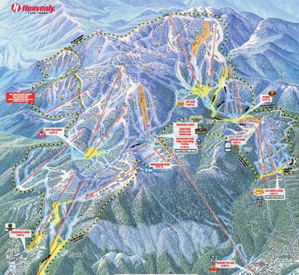
At some point accuracy starts to interfere with usability.
LOL. Well said.
The worst parts are the trail connectors. With virtually zero point of reference, it's very easy to miss unless you're familiar with the mountain.