awf170
New member
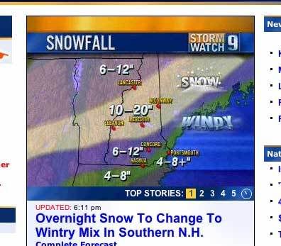
The sleet is going to hit everywhere. Just watch. You might be able to avoid it at Sugarloaf, Saddleback, and Jay, but I still wouldn't be surprised if they got some too. I'm not trying to be negative but weatherman always underestimate the power of warm air over-riding.
Sleet makes a good base!
Sleet makes a good base!

")