threecy
New member
Todd Mountain, MA, Adams Mountain, MA
Date Hiked: 03/12/07
Trails(s) Hiked: Sabrina Rice Trail, Todd Mountain Trail, Adams Mountain Trail, more
Difficulty: Moderate
Distance: 4.7 miles
Conditions: Wet granular, broken trail, unbroken trail, packed snowmobile
After months of thinking about hiking Todd Mountain (Rowe) and Adams Mountain, I was finally able to attain a map of the Pelham Lake Park trail system from a local backcountry skier. On my way back from Spruce Hill the day before, I scouted out a trailhead on Davis Mine Road, which had room to park and a sign announcing the trail.
Despite the mid 40 degree weather and the apparently broken out trail, I decided to put on my snowshoes. A great choice, as the Todd Mountain Trail hadn't seen any traffic since possibly two storms ago.
The Todd Mountain Trail was short and moderately steep, ending at the viewless summit. From there, the trail continued southwest toward the Adams Mountain Trail intersection.
The Adams Mountain Trail started with a decent pitch, but then became increasingly gradual as the summit neared. The summit itself had no views, however there was an unbroken but signed trail to a vista on the east side of the mountain. Mt. Monadnock, Burnt Hill, Berkshire East Ski Area, and Mount Peak were all visible from here.
After seeing some peaks through the trees to the north and west, I decided to follow a sign to the "North West View Trail." After a half of a mile I encountered a sign telling me how far I had hiked, but with no reference to the North West View Trail, but rather Old Kings Highway, something I didn't want. Oh well.
Not wanting to hike back up Todd Mountain, I instead cut down to the Williams Trail (and noticed another reference to a northwestern view, only a fraction of a mile away) and back over to the Sabrina Rice Trail, following the well packed snowmobile tracks.
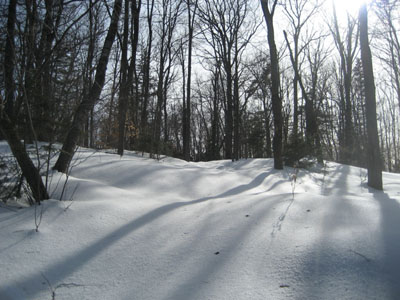
Todd Mountain Trail
Date Hiked: 03/12/07
Trails(s) Hiked: Sabrina Rice Trail, Todd Mountain Trail, Adams Mountain Trail, more
Difficulty: Moderate
Distance: 4.7 miles
Conditions: Wet granular, broken trail, unbroken trail, packed snowmobile
After months of thinking about hiking Todd Mountain (Rowe) and Adams Mountain, I was finally able to attain a map of the Pelham Lake Park trail system from a local backcountry skier. On my way back from Spruce Hill the day before, I scouted out a trailhead on Davis Mine Road, which had room to park and a sign announcing the trail.
Despite the mid 40 degree weather and the apparently broken out trail, I decided to put on my snowshoes. A great choice, as the Todd Mountain Trail hadn't seen any traffic since possibly two storms ago.
The Todd Mountain Trail was short and moderately steep, ending at the viewless summit. From there, the trail continued southwest toward the Adams Mountain Trail intersection.
The Adams Mountain Trail started with a decent pitch, but then became increasingly gradual as the summit neared. The summit itself had no views, however there was an unbroken but signed trail to a vista on the east side of the mountain. Mt. Monadnock, Burnt Hill, Berkshire East Ski Area, and Mount Peak were all visible from here.
After seeing some peaks through the trees to the north and west, I decided to follow a sign to the "North West View Trail." After a half of a mile I encountered a sign telling me how far I had hiked, but with no reference to the North West View Trail, but rather Old Kings Highway, something I didn't want. Oh well.
Not wanting to hike back up Todd Mountain, I instead cut down to the Williams Trail (and noticed another reference to a northwestern view, only a fraction of a mile away) and back over to the Sabrina Rice Trail, following the well packed snowmobile tracks.
Todd Mountain Trail