• Welcome to AlpineZone, the largest online community of skiers and snowboarders in the Northeast!

    You may have to REGISTER before you can post. Registering is FREE, gets rid of the majority of advertisements, and lets you participate in giveaways and other AlpineZone events!

3/6-3/7 storm?

BenedictGomez

Well-known member
Joined
Jan 26, 2011
Messages
12,182
Points
113
Location
Wasatch Back
The only useful information that may be drawn from this, is the fact that The Weather Channel is being as hyperbolic and intentionaly misleading as usual, to drum up hysteria and television ratings.

88341010152672876245122.jpg
 

billski

Active member
Joined
Feb 22, 2005
Messages
16,207
Points
38
Location
North Reading, Mass.
Website
ski.iabsi.com
This thing is a cut-off low just sitting out there and could carry into Friday a bit but I am leaning towards snowfall diminishing then--most of the effects look to be offshore anyways. Monday looks like some mixed/rain showers with higher snow levels.

Yeah. I've got a hunch that spring skiing starts next week. What'cha think WC?
 

BenedictGomez

Well-known member
Joined
Jan 26, 2011
Messages
12,182
Points
113
Location
Wasatch Back
The 00z NAM is out, and if it verified it would absolutely pummel the Catskills and DAX with heavy snow.

It's weird, basically after departing NJ to the northeast, the entire precipitation shield wraps around itself, like h2o spinning down a drain or a golfball going 360 degrees around a cup, and comes all the way back to NJ again. In the middle of that there's >1" per hour snowfall in NY.

Of course, it's the NAM and that model have overjuiced the snow all winter, but......

p1gzd5pn0540000.gif
 

riverc0il

New member
Joined
Jul 10, 2001
Messages
13,039
Points
0
Location
Ashland, NH
Website
www.thesnowway.com
http://www.mattnoyes.net/new_englan...ast-for-wednesday-evening-to-friday-dawn.html

Matt Noyes with a really insightful post about how mets take computer precipitation guidance and come up with forecast amounts.
Noyes is really conservative. Always a good watch for minimum expectations. He holds his cards close and waits as long as possible on accumulation predictions. He seems really concerned with public perception and the delicate balance between giving people enough warning but not hyping. I can respect that. But on the flip side, I'd rather hear Tim Kelly deliver a forecast because, even with the maps, he'll drop hints at where he thinks has a good possibility on getting more snow and of course isn't afraid to call out particular ski areas even on the air.
 

drjeff

Well-known member
Joined
Jan 18, 2006
Messages
19,221
Points
113
Location
Brooklyn, CT
The only useful information that may be drawn from this, is the fact that The Weather Channel is being as hyperbolic and intentionaly misleading as usual, to drum up hysteria and television ratings.

88341010152672876245122.jpg

Cool! Based on all those estimate maps, I can expect somewhere between 2-18" at my house! :lol: :rolleyes:

Actually what all these maps are in consensus about is that with all the relatively "warm" air around and available for this storm, that geographically there won't be very much distance between where the largest amounts fall and where very little falls! A few miles variance in this storm track WILL make a large difference
 

octopus

Member
Joined
May 4, 2008
Messages
397
Points
16
Location
mass
do you guys think ANY new england mtns will get decent snow out of this?
 

ScottySkis

Well-known member
Joined
Jan 16, 2011
Messages
12,294
Points
48
Location
Middletown NY
36 inches of snow tomorrow I predict, because I turn 36 tomorrow, my birthday gift to everyone here.:)
 

BenedictGomez

Well-known member
Joined
Jan 26, 2011
Messages
12,182
Points
113
Location
Wasatch Back
Frankly, this storm is happening right now, and people still have no idea what's going to happen. WAY too many options and possibilities.

Really adds a dose of reality and humbleness to man's belief in its' capabilities for predicting the weather.
 

ScottySkis

Well-known member
Joined
Jan 16, 2011
Messages
12,294
Points
48
Location
Middletown NY
Frankly, this storm is happening right now, and people still have no idea what's going to happen. WAY too many options and possibilities.

Really adds a dose of reality and humbleness to man's belief in its' capabilities for predicting the weather.

You think Platty might get some snow, either way this weekend looking good in the Catskills, 40s for highs and Sunny.:):):)
 

drjeff

Well-known member
Joined
Jan 18, 2006
Messages
19,221
Points
113
Location
Brooklyn, CT
If they get lucky, So. VT will win. Just wonder how "wet" the snow will be so far inland.

Given that realistically it's not going to be much colder than the mid 20's and there's already strong winds out of the East saturating the atmosphere in SoVT now ahead of the main batch of moisture associated with the storm, we're NOT going to be looking at 5% Utah-esque "blower snow" from this one ;)
 

octopus

Member
Joined
May 4, 2008
Messages
397
Points
16
Location
mass
Frankly, this storm is happening right now, and people still have no idea what's going to happen. WAY too many options and possibilities.

Really adds a dose of reality and humbleness to man's belief in its' capabilities for predicting the weather.


This seems to be happening a lot lately, the weather people are "predicting" the weather as it happens, I could do that. I just look for the prettiest weather girl, at least I have something to look at while they f' up the forecast.
 

BenedictGomez

Well-known member
Joined
Jan 26, 2011
Messages
12,182
Points
113
Location
Wasatch Back
This seems to be happening a lot lately, the weather people are "predicting" the weather as it happens, I could do that. I just look for the prettiest weather girl, at least I have something to look at while they f' up the forecast.

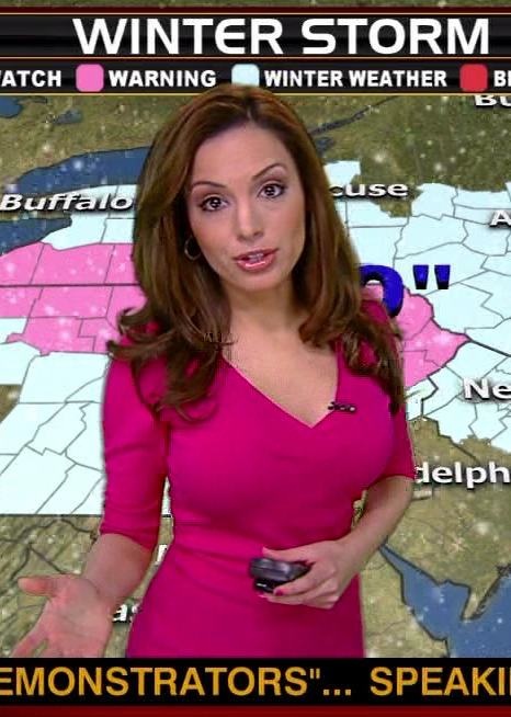
Then you may want to consider Maria Molina.

maria-molina-nice+breast+big+tits+sexy+b.jpg
 

WinnChill

New member
Joined
Nov 13, 2009
Messages
921
Points
0
Ah, how original. The forecast changes and then the meteorologist bashing begins. This is a thread to discuss the storm---and some of us go out of our way to help you all find the best powder possible. If the sexist, degrading, trolling/flaming is your thing, and cannot post something to further the discussion about the storm, then perhaps this thread/forum isn't for you. There certainly seems to be a little too much of that going on lately.
 

St. Bear

New member
Joined
Dec 22, 2008
Messages
2,946
Points
0
Location
Washington, NJ
Website
twitter.com
Winn, yesterday both Henry Margurity of Accuweather and Lionel Hutz of FIS mentioned the storm being sucked NW by a low coming out of Canada, resulting in extended snow for the ADK into Fri? Do you see that happening?
 

WinnChill

New member
Joined
Nov 13, 2009
Messages
921
Points
0
do you guys think ANY new england mtns will get decent snow out of this?

We weren't really expecting decent snow out of this to begin with. As we mentioned in our forecast discussions, the upper level winds just did not favor this storm curling into us for big snow through VT/NH/ME. If anyone, MA/CT is (and has been) in the most favorable position to score something. The secondary disturbance that sneaks in from the west may deliver some light accumulations for the Cats/Ads, but aside from that this was not expected to be a big delivery of snow.
 
Top