• Welcome to AlpineZone, the largest online community of skiers and snowboarders in the Northeast!

    You may have to REGISTER before you can post. Registering is FREE, gets rid of the majority of advertisements, and lets you participate in giveaways and other AlpineZone events!

Snow..coming ???

Jully

Active member
Joined
Dec 13, 2014
Messages
2,487
Points
38
Location
Boston, MA
Booked a room in Rutland for Saturday just in case this performs well. Rooms appear to be booking up with the storm potential, and since I can cancel up to Friday afternoon figured why not. Figure that is a good place to base out of in the event K gets a good dump or SoVT does depending on where this thing goes.

Now since I actually was pro-active for once in trying to secure a room on short notice instead of re-active, this storm will probably not deliver.

Figuring out where to go this weekend is a bit of a challenge for sure. Trying to decide between grabbing a room by Sunday River/the MWV or staying home. If the storm doesn't deliver and/or bombs down south, I'll want to be up north, but if Crotched gets nailed, even if it is nailed with wet slop, I'll probably still wish I was down there.
 

Rowsdower

Member
Joined
Dec 16, 2013
Messages
818
Points
18
Location
Upper Bucks/Lehigh Valley, PA
I'm not seeing what you guys are seeing. Unless this thing is a serious elevation performer, it looks like the changeover mid storm will depress snowfall totals and leave whatever is on the ground as slop, not snow.

Actually right now it looks like Hunter and parts of the Catskills could come through ok, but its gonna be a close call.

Edit: I'm gonna pull the trigger on a room up in the Cattys anyway. If this thing comes together Hunter and Platty will be going off. Reminds me of the March 17th storm last year.
 

tnt1234

Well-known member
Joined
Sep 12, 2014
Messages
1,492
Points
48
I'm not seeing what you guys are seeing. Unless this thing is a serious elevation performer, it looks like the changeover mid storm will depress snowfall totals and leave whatever is on the ground as slop, not snow.

Actually right now it looks like Hunter and parts of the Catskills could come through ok, but its gonna be a close call.

Edit: I'm gonna pull the trigger on a room up in the Cattys anyway. If this thing comes together Hunter and Platty will be going off. Reminds me of the March 17th storm last year.

Any idea what kind of shape Platte is in right now? though I guess if they get 20" of wet snow, it doesn't matter - that would open up the whole place I suppose.
 

sankaty

Member
Joined
Mar 11, 2006
Messages
226
Points
18
Location
Central CT
12Z Euro looks great for the Catskills. More than a foot of snow in Windham, NY. It's much cooler than its 0Z run. As modeled, it might start mixed with some raindrops, but surface temps quickly fall to around 30F for the heart of the event, so it probably wouldn't even be a super wet snow if that model run verified.

It shows a more moderate event for S VT with about 6 inches at Stratton. Still pretty dry north of there, tapering to only a couple of inches in the Killington area. I'm hoping it ramps up the precip over VT over the next few runs, but there's no particular reason to think it will other than standard model wobbles.
 

hammer

Active member
Joined
Apr 28, 2004
Messages
5,493
Points
38
Location
flatlands of Mass.
Have a room booked for the weekend at Killington, reserved several months ago. Can't cancel that, and we already bought tickets, so unless the drive is undoable we will be there.

Thoughts on the drive up on Friday and conditions on Saturday? Trying to see if there will be a better or worse time to drive up from Mass.
 

sankaty

Member
Joined
Mar 11, 2006
Messages
226
Points
18
Location
Central CT
Have a room booked for the weekend at Killington, reserved several months ago. Can't cancel that, and we already bought tickets, so unless the drive is undoable we will be there.

Thoughts on the drive up on Friday and conditions on Saturday? Trying to see if there will be a better or worse time to drive up from Mass.

Given the uncertainty with the placement and type of precip, it's really hard to make a guess on how bad travel will be. The timing is bad, with greatest amount of precip falling between 10AM and 10PM Friday. With a little luck for travelers, it could be mostly wet in the I-91 valley with most of the snow relegated to the higher elevations. In fact, that's kind of what the Euro is currently showing, but it has been cooling with each successive run, so who knows what will actually happen.

Right now, the most difficult travel looks like it would be from NW MA into S VT, but that could change.
 

x10003q

Active member
Joined
Aug 14, 2009
Messages
913
Points
43
Location
Bergen County, NJ
This storm is going to drop a mess on the roads from the flatlands to the mountains making the Friday drive north a pain in the ass while dropping only a few flakes on the mountains. The only thing worse than this for weekend warriors is a Sunday snow storm for the ride home.:???:
 

Kleetus

Member
Joined
Oct 6, 2013
Messages
329
Points
16
Location
Baldwinsville, Ny
I'm not seeing what you guys are seeing. Unless this thing is a serious elevation performer, it looks like the changeover mid storm will depress snowfall totals and leave whatever is on the ground as slop, not snow.

Actually right now it looks like Hunter and parts of the Catskills could come through ok, but its gonna be a close call.

Edit: I'm gonna pull the trigger on a room up in the Cattys anyway. If this thing comes together Hunter and Platty will be going off. Reminds me of the March 17th storm last year.

This is my plan B. If things come together for the Cats, will cancel the Rutland room and get a place down there.
 

podunk77

Member
Joined
Feb 17, 2012
Messages
119
Points
18
Hoping for good karma for the Cats but also for Catamount and Butternut, where I'll be for a portion of next week.
 

KustyTheKlown

Well-known member
Joined
Mar 1, 2013
Messages
5,406
Points
113
Location
Brooklyn
I give no credence to the GFS 15 days out, but ugh march 14-17 is looking problematic AF at the moment. :evil:
 

BenedictGomez

Well-known member
Joined
Jan 26, 2011
Messages
12,182
Points
113
Location
Wasatch Back
I'm not seeing what you guys are seeing. Unless this thing is a serious elevation performer, it looks like the changeover mid storm will depress snowfall totals

Actually right now it looks like Hunter and parts of the Catskills could come through ok, but its gonna be a close call.

This.

Unless the models are pretty off, this isnt going to do much for anyone other than NYS and maybe s.VT if they get lucky.

Any idea what kind of shape Platte is in right now? though I guess if they get 20" of wet snow, it doesn't matter - that would open up the whole place I suppose.

LOOKS TERRIBLE. I had the same thought, that if they get 15" maybe I'll head up on Sunday after the wind dies. But looking at these webcams makes you want to cry. Bare ground all over it seems. I had no idea they got trashed so bad :(

Platty_wrecked.jpg
 

KustyTheKlown

Well-known member
Joined
Mar 1, 2013
Messages
5,406
Points
113
Location
Brooklyn
ugh^ (re: plattekill photos)

while I'm not giving up yet and have faith that march will provide, it's warm and sunny in nyc, and I can't even ride my bike. two weeks ago I dropped my keys (car, apartment, bike locks, and work remote access device) down a NYC sewer. everything was replaceable except for the bike keys, and now I need to find someone to help me cut bike locks.
 

Glenn

Active member
Joined
Oct 1, 2008
Messages
7,691
Points
38
Location
CT & VT
The ride up Friday could be interesting. We've had a few that had us in the rain for 90% of the ride up 91, then we hit Bernardston and things get snowy in a hurry. Happened for me in that late February/Early March storm a few years back; "Mt. Snow "Snowicane"" as they called it. Then again for that foot of fresh a few Thanksgivings ago. I remember we hopped off Exit 1 after seeing close to 10 cars off the road and one big rig stuck on the hill just north of the Welcome Center.
 

drjeff

Well-known member
Joined
Jan 18, 2006
Messages
19,216
Points
113
Location
Brooklyn, CT
The ride up Friday could be interesting. We've had a few that had us in the rain for 90% of the ride up 91, then we hit Bernardston and things get snowy in a hurry. Happened for me in that late February/Early March storm a few years back; "Mt. Snow "Snowicane"" as they called it. Then again for that foot of fresh a few Thanksgivings ago. I remember we hopped off Exit 1 after seeing close to 10 cars off the road and one big rig stuck on the hill just north of the Welcome Center.

Yup!!!

Gotta go to the condo at Mount Snow 1st, and then grab E and head up to just North of Killington Friday night ahead of her state meet at Middlebury Snowbowl Saturday-Monday.....

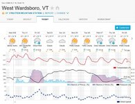
And that's after making a bit of a white knuckle drive this past Sunday AM from the condo up to Pico for D's race.... First tracks sometimes are great. First tracks on a DARK 100 north descending the 11 or so miles from the Mount Snow area down to 30 in Wardsboro in the dark with heavy snow before the plows hit it, isn't fun!!!
 

legalskier

New member
Joined
Sep 22, 2008
Messages
3,052
Points
0
I had the same thought, that if they get 15" maybe I'll head up on Sunday after the wind dies.

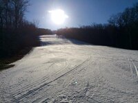
Platty's been having a rough time of it lately- hopefully this storm will deliver. At Belle yesterday I was surprised how well their base is holding up- here's Dot Nebel:

FullSizeRender(3).jpg
There was a lot of chatter on the lift rides about the expected snows, not only on Friday but several times next week. Some nice natural on top of this base and they'll be in very nice shape. *fingers crossed*
 
Last edited:

sankaty

Member
Joined
Mar 11, 2006
Messages
226
Points
18
Location
Central CT
I'm really not too concerned about warmth for the ski areas at this point. The models are tending cooler in the boundary layer with each run. The big question is whether heavy precip makes it north of the Catskills. If it does, I'm confident it will be at least 90% snow.

I don't put too much stock in the NAM, the the 18Z run that is coming out now is crazy. It prints out almost 20" of snow for NYC. Far southern NJ sees more than a foot of snow in 6 hours. I don't think this will happen, but the point is each run shows a new evolution. The main constant has been that the Catskills do OK, but it's touch and go getting precip further north. The latest NAM shows about 20" for the Catskills, about a foot for Mt. Snow/Stratton, 6-8 Killington/Pico, and not much north of there. The NAM is notorious for overdoing precip and has been all over the place, so I don't think these numbers mean much in isolation.
 
Top