bzrperfspec77
Member
Keep moving west!
Welcome to AlpineZone, the largest online community of skiers and snowboarders in the Northeast!
You may have to REGISTER before you can post. Registering is FREE, gets rid of the majority of advertisements, and lets you participate in giveaways and other AlpineZone events!
My god. Did you just see that last GFS run for E MA
Do tell!
Are we talking weekend?
Post it?
Nice to see Smuggs and Stowe get some goods last night.


Cool. I'll go start my storm prep now!BOX is using last nights models. Expect a big jump at 4pm
")

Totals?
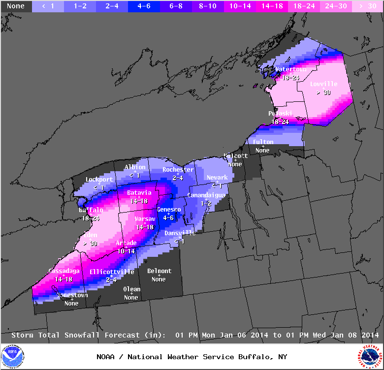
Anyone know where I could find a season snowfall total for the Tug Hill? They've been getting one 2 foot+ snowstorm after another...Freaking great lakes, Off the charts...