• Welcome to AlpineZone, the largest online community of skiers and snowboarders in the Northeast!

    You may have to REGISTER before you can post. Registering is FREE, gets rid of the majority of advertisements, and lets you participate in giveaways and other AlpineZone events!

Week of February 2nd, storm speculation

BenedictGomez

Well-known member
Joined
Jan 26, 2011
Messages
12,185
Points
113
Location
Wasatch Back
And another late entry..... This is from the guy who touched off the media snowpocalypse firestorm!
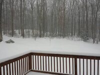
1780917_10153875532900122_2061757_n.jpg
 

BenedictGomez

Well-known member
Joined
Jan 26, 2011
Messages
12,185
Points
113
Location
Wasatch Back
They have no clue still. Must all be rusty due to the boring winter. I've seen 3-12" in my area depending on the news network.

This has been bizarre though. Even the short-range models are flipping and flopping. It's going north! No, no, it's on the prior track.... it's going north again!!! No, no....it's WARMER......oops now it's COLDER... All that has major implications.

Just as soon as everyone was increasing snow totals up north, they started decreasing them again etc... I'm not sure I've seen such model mayhem before. Everyone has a different opinion of what's going to happen, and they're not crazy, just using different assumptions and logic. It has certainly been interesting (and frustrating) following this one.

And I'm in a projected "ice epicenter", hopefully I have power when I wake up.
 

Not Sure

Well-known member
Joined
Dec 14, 2013
Messages
2,858
Points
63
Location
Lehigh County Pa.
Website
www.youtube.com
And I'm in a projected "ice epicenter", hopefully I have power when I wake up.[/QUOTE]


That was my biggest concern all day. With such close timming between storms, The trees still have a lot of snow on them , no chance to blow or melt off. Add more snow then frezzing rain.
I'm used to power outages and have a generator but haven't had to use it in winter for some time, this could get ugly.
I've been watching the radar for the last few hours.A scene from The "Mummy " comes to mind.
The sand head swallowing the airplane.
 

Wavewheeler

New member
Joined
Feb 25, 2012
Messages
495
Points
0
Location
The Jersey Shore
Fortunately I'm right on the shore and it's looking like freezing rain to rain. No accumulation. I have to work tomorrow but I'm off early, getting packed and will head up early Thursday morning to beat the rush hour.
Its good thing I drive a Jeep! This is going to be AWESOME! :thumbup: :snow: Yes, my snow hating friends are all bitching about the 2" of slush we are supposed to get tonight and tomorrow. :rolleyes: I will be leaving it behind to head north to enjoy a FOOT of the good stuff! :snow:

...winter storm warning remains in effect from midnight tonight
to 6 pm est wednesday...

* locations...all of east central new york...southern vermont...
Western massachusetts and northwest connecticut.

* hazard types...heavy snow.

* snow accumulations... 8 to 12 inches of snow...with 12 to 15
inches in the higher elevations of the eastern catskills...
Berkshires and southern green mountains.


* maximum snowfall rates...one inch per hour.

* timing...late tonight through wednesday.

* impacts...dangerous travel conditions late tonight through
wednesday...especially the wednesday morning commute...possibly
into the wednesday evening commute.
 
Last edited:

abc

Well-known member
Joined
Mar 2, 2008
Messages
5,868
Points
113
Location
Lower Hudson Valley
They have no clue still. Must all be rusty due to the boring winter. I've seen 3-12" in my area depending on the news network.
Is it really that strange?

It's a storm that packs lots of moisture, and there's cold air to make those moisture turn snow. Or ICE!

So either way, it's going to be messy for the coast. And where it doesn't turn into ice, there'll be tons of snow! Seems pretty straight forward to me.

What's NOT straight forward, of course, is where exactly the ice line is, because that affects the snow total.

Though given the storm is already formed, I would have expected they can be a little bit more accurate. After all, whichever model that predicted the current track correctly should get more weight in predicting the next 12 hrs!
 

Fowtwuntee

New member
Joined
Jan 29, 2014
Messages
16
Points
0
Shaping up to be a good week. Storm finally about to hit New England with another on the way this Sunday! Keep on doing the snow dance.
 

Cornhead

Well-known member
Joined
Dec 4, 2010
Messages
2,839
Points
48
Solid foot in Binghamton, NY and still snowing, nothing prior to 3AM. Halfway done shoveling, sick call made, heading to Greek Peak in about an hour, stoked!

Sent from my DROID X2 using Tapatalk 2
 

BenedictGomez

Well-known member
Joined
Jan 26, 2011
Messages
12,185
Points
113
Location
Wasatch Back
Solid foot in Binghamton, NY and still snowing, nothing prior to 3AM. Halfway done shoveling, sick call made, heading to Greek Peak in about an hour, stoked!

Sent from my DROID X2 using Tapatalk 2

Holy crap! And it's going to keep snowing for a while yet there. Have fun.

Personally I'm just glad I woke up with electricity here.


EDIT: Everything looks still right on tap for the Cats. And I think the Poconos were spared the worst of the sleet and got mostly snow. They were tip-toeing right near the snow/sleet line.
 
Last edited:
Joined
Sep 15, 2012
Messages
780
Points
16
Location
Boston
Ripping. About 5 inches in 2.5 hours!

That "lull" over Western NY is actually a product of the Buffalo radar being down for today. In fact it's still ripping all the way back there!
 
Top