• Welcome to AlpineZone, the largest online community of skiers and snowboarders in the Northeast!

    You may have to REGISTER before you can post. Registering is FREE, gets rid of the majority of advertisements, and lets you participate in giveaways and other AlpineZone events!

A Forecast for Friday and Saturday

loafer89

New member
Joined
Apr 21, 2004
Messages
3,978
Points
0
Location
Enfield, C.T
This storm looked like it dumped snow more along the coastal areas than anywhere else. Sugarloaf only seems to have gotten a dusting of new snow. We got a little over 1" here and we just had our driveway plowed and it's still snowing, but lightly.

The wind looks brutal for tonight and on saturday.

NOAA is talking about a possible snowstorm next week, and also a posible pattern change to warmer weather by February.
 

Marc

New member
Joined
Sep 12, 2005
Messages
7,526
Points
0
Location
Dudley, MA
Website
www.marcpmc.com
This storm looked like it dumped snow more along the coastal areas than anywhere else. Sugarloaf only seems to have gotten a dusting of new snow. We got a little over 1" here and we just had our driveway plowed and it's still snowing, but lightly.

The wind looks brutal for tonight and on saturday.

NOAA is talking about a possible snowstorm next week, and also a posible pattern change to warmer weather by February.

Alright, see now, that last sentence was just not necessary.
 

loafer89

New member
Joined
Apr 21, 2004
Messages
3,978
Points
0
Location
Enfield, C.T
You and me both Dave. If Loafer comes to an outing, there may be duct tape coming along.

Ha,Ha very funny. I don't make the weather I just listen to what NOAA says.

At least we have the cold weather and snowmaking for right now, though the high winds may keep alot of lifts closed this weekend.

It's snowing really hard here at home.
 

adamti91

New member
Joined
Jan 10, 2007
Messages
496
Points
0
Location
eugene oregon
Snow is moving in from the West, should be hitting Albany and the Western Cats again soon... Maybe the Berkshires a little later this morning.
 

loafer89

New member
Joined
Apr 21, 2004
Messages
3,978
Points
0
Location
Enfield, C.T
GGEM 10 DAY 850 TT ANOMALY IS LOOKING BETTER AND BETTER WITH
ESSENTIALLY COLDER THAN NORMAL AIR PERSISTING HERE FOR AT LEAST THE
NEXT 10 DAYS. AND WHILE THE AO MAY BOUNCE BACK STRONGLY POSITIVE...
THERE'S NO GUARANTEE OF ITS OCCURRENCE BEING THE CONTROLLING FACTOR
FOR N AMERICA.


See it says it MAY happen
 

loafer89

New member
Joined
Apr 21, 2004
Messages
3,978
Points
0
Location
Enfield, C.T
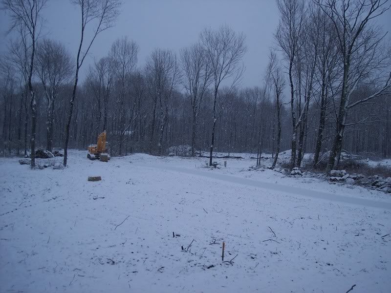
Nice view from my window:

Home.jpg
 

Marc

New member
Joined
Sep 12, 2005
Messages
7,526
Points
0
Location
Dudley, MA
Website
www.marcpmc.com
Ha,Ha very funny. I don't make the weather I just listen to what NOAA says.

At least we have the cold weather and snowmaking for right now, though the high winds may keep alot of lifts closed this weekend.

It's snowing really hard here at home.

Hey man, you're a skier, you know how this works.


When there's adverse weather in a ski forecast, a shoot the messenger attitude is always to be expected.
 

ALLSKIING

Moderator
Staff member
Moderator
Joined
Jan 6, 2005
Messages
6,971
Points
48
Location
East Setauket,NY/Killington,VT
Take this for what its worth.


Herb's Ski Weather Forecast Home
Friday, January 19 2007 @ 09:03 AM
Contributed by: Herb Stevens

This morning’s discussion will be short and sweet...winter is here, and it only just beginning to show its’ teeth. The large scale ridge that has been centered over the southeastern states is now about done, and it has been replaced by a deepening trough of low pressure at the jet stream level. The ridge was largely responsible for the extended period of above normal temperatures that tormented skiers and riders in the East for the past 5 weeks, while our western counterparts enjoyed an abundance of snow. The worm has turned, and while widespread heavy snow has yet to arrive in the East...it won’t be long now.

As we head into this weekend, cold air has been established from the Rockies eastward to the Atlantic coast. It wasn’t cold enough for last night’s quick moving low pressure center to produce snow along the coast in southern New England, due to the warmth of the adjacent ocean waters, but that same warmth is going to play a large role in the stormy weather of the coming weeks. The northwest Atlantic is quite a bit warmer than normal, so any system that comes along, whether it is a full blown coastal that originated in the southern Plains or Gulf of Mexico or a southeastward moving Alberta Clipper, will become a stronger system upon interaction with the energy that is stored up in the warm water. The El Nino is dying, but it is still sending a stream of impulses along in the southern branch of the jet stream, and each one will have the potential to interact with the northern branch and produce a good-sized storm. Mark my words...there will be at least one, if not two or three, blockbuster coastal storms that come out of this pattern, simply because there are too many pieces in place not to have that happen. The threat of significant snow is not limited to the northeast, either, as the cold will penetrate far enough south to set up the resorts in the central and southern Appalachians for a bounty of snow over the next several weeks. The Great Lakes will also be cranking out copious amounts of powder, too, due to lake effect snows enhanced by...you guessed it, warmer than normal water. Global Warming? No, no, no...the warm lake water is just the by-product of the pattern that we have been in. In the Atlantic, we have entered the warm phase of the AMO, or Atlantic Multidecadal Oscillation, and water temps will tend to be elevated for quite a while now (it’s called “Multidecadal” for a reason).

In the shorter term, another shot of arctic air is going to move into the northeast this weekend, and set off lake effect snow in the process. Resorts from upstate New York and northern Ohio down to western Pennsylvania and the mountains of West Virginia will pick up 4 to 6 inches of fluff later today and tonight, with some spots close to the lakes looking at a foot of powder come Saturday morning. New England is going to have a very cold, windy Saturday, and there may be some disruption to the operation of lifts as a result. Another fast moving system will spread snow into the central Appalachians by later Sunday, and the Northeast will see a couple of inches of snow Sunday night and Monday. The same system will be dumping very heavy snow, on the order of 1 to 2 feet, on areas in Arizona and New Mexico tonight and tomorrow. By the middle of next week, the pattern looks ripe for a northern branch system to phase with the southern branch and generate a larger storm that would run up the east coast. By that time, the NAO, or North Atlantic Oscillation, will be in the negative phase for the first time since October, and that will help to turn the storm up the coast, rather than let it simply run eastward and out to sea. In the wake of that storm, yet another shot of arctic air will cruise into the eastern half of the U.S., and right now, it looks to me as though the cold will only deepen as we head into February.

If you are thinking of heading west and you insist on having some powder to play in, stay south of I-70 the rest of the winter. While a deep trough will dominate in the East until further notice, a complimentary ridge will be in place over the northern Rockies and British Columbia. That ridge will protect the mountains from Pacific storms, and limit new snow. Keep in mind, thought that resorts in the northern Rockies and the Cascades of Washington and Oregon have plenty of snow, thanks to repeated poundings earlier in the season. The southern Rockies, however, will be hit by storms running along in the southern branch of the jet, as the dying El Nino fires its final shots over the next 45 days or so. All in all, the picture is getting prettier and prettier by the day nationwide. In a week or two, it will be hard to find a section of the U.S. or Canada that isn’t happy with their conditions...quite a change from just a week ago.


--------------------------------------------------------------------------------
 

kingslug

Well-known member
Joined
Dec 30, 2005
Messages
7,278
Points
113
Location
Draper utah
Going to Tahoe Feb 5, hope they get some as they haven't in a while. My luck would be pounding in the N east and nothing in California. But then this is home so it all works out when I get back.
 

loafer89

New member
Joined
Apr 21, 2004
Messages
3,978
Points
0
Location
Enfield, C.T
Hopefully Mammoth gets into some more snow action to allow some turns in June. Right now they only have a 36-48" base and are still making snow on some trails.

Last year they had 668" of snow, so far this season they only have 76"
 

loafer89

New member
Joined
Apr 21, 2004
Messages
3,978
Points
0
Location
Enfield, C.T
Gray Maine forecast discussion:

THE MAIN CONCERN WILL BE FOR LATE NEXT WEEK WHERE MODELS ARE
TRYING TO BE CONVINCING AND CONTINUE TO SHOW A MAJOR EVENT TO
TAKE PLACE OFF THE MID ATLANTIC AND NORTHEAST COAST. SEVERAL
MODELS HAVE BEEN HINTING AT A POTENTIAL MAJOR SNOWSTORM WITH
BOMBOGENISIS FOR THURSDAY AND FRIDAY AS THEY DRIVE A MAJOR PIECE
OF THE POLAR JET SOUTHEAST AND DEVELOP A MAJOR EVENT AS THE ENTIRE
VORTEX GOES VERTICAL OFF THE COAST BY LATE THURSDAY AND FRIDAY. IF
ONE WERE TO BELIEVE THE 12Z GFS WE WOULD HAVE "THE MOTHER OF ALL
SNOWSTORMS"
. BUT...CONSIDERING ITS A LONG WAY OFF IN TIME THERE IS
CERTAINLY PLENTY OF CHANGES IN THE MODELS EXPECTED BETWEEN NOW AND
LATE NEXT WEEK...WILL MONITOR THE CONTINUITY IN THE RUNS FOR NOW.
AS FAR AS THE FORECAST STANDPOINT WILL SIMPLY MENTION A CHANCE OF
SNOW LATE NEXT WEEK AND CONTINUED BELOW NORMAL TEMPERATURES.

Oh please, oh please, oh please:spin: :spin: :spin: :spin:
 
Top