• Welcome to AlpineZone, the largest online community of skiers and snowboarders in the Northeast!

    You may have to REGISTER before you can post. Registering is FREE, gets rid of the majority of advertisements, and lets you participate in giveaways and other AlpineZone events!

Cannon Lover's Thread

ceo

Active member
Joined
Apr 1, 2009
Messages
422
Points
28
The whole aspect on the left side of Mittetsill, basically between Wicked Hard and Saddle/Baron's Run should be trails and/or glades.
Looking at OpenSkiMap, that's potentially doable, it's slightly less steep than Kinsman Glade and Tramline. The problem is that roughly half of that area was part of the land swap with the Forest Service that enabled the reopening of Mittersill, and is therefore subject to the prohibition on clearing land above 2500'.

The 1998 expansion plan that included the Peabody Quad and Tuckerbrook also included a chair to the top of the Saddle and a trail basically down the ridgeline to skier's right of Baron's Run, with a glade in between. There's a map here. The same plan also included a trail from Bypass into the top of the Banshee area, which would be insanely steep.
 

thebigo

Well-known member
Joined
May 15, 2005
Messages
2,098
Points
113
Location
NH seacoast
Pony express holds snow because it is off map. A groomer there would be a windblown hellscape more often than anything remotely enjoyable.
 

thebigo

Well-known member
Joined
May 15, 2005
Messages
2,098
Points
113
Location
NH seacoast
I remember that master plan on the wall of the tram base station. I was hiking with my dad, must have been mid 90s? Asked one of the park workers about Kinsman, remember he replied it was the 'dream trail'.

I don't remember a trail above banshee and unfortunately only the mittersill side of the map is readily available on the normal ski map websites. The entire master plan has to be somewhere online.

Edit - found reference to "banshee extension" in an old article:

"A new expert trail from the top of Paulie's Folly Extension to the top of the Banshee area."

"The new trail from PFE to Banshee (which I'm going to refer to as "Banshee Extension") will be 600 vertical feet at a 60% average grade(!!); by contrast, Paulie's Folly proper is about a 45% grade. It wll be the steepest trail at Cannon, and one of the steepest trails in the East."

 
Last edited:

Puck it

Well-known member
Joined
Oct 26, 2006
Messages
9,714
Points
48
Location
Franconia, NH
Looking at OpenSkiMap, that's potentially doable, it's slightly less steep than Kinsman Glade and Tramline. The problem is that roughly half of that area was part of the land swap with the Forest Service that enabled the reopening of Mittersill, and is therefore subject to the prohibition on clearing land above 2500'.

The 1998 expansion plan that included the Peabody Quad and Tuckerbrook also included a chair to the top of the Saddle and a trail basically down the ridgeline to skier's right of Baron's Run, with a glade in between. There's a map here. The same plan also included a trail from Bypass into the top of the Banshee area, which would be insanely steep.
There was never a plan to do any trail or lift from the top of the peak of Mitty. Also, Bicknell Thrush is no longer on the. Bear Gut is the to endangered list so they can do what they want as far as I know. Anything off that ridge is very steep and there is a alreadt an "Obvious" glade off it and would run down into a stream bed. Bunny Direct or Pony Express would be the only option for a trail and would not hold up to traffic. As for trails off Bypass, there are a couple already off the map though. One is not bad but very tight at the top. Bear Gut is the other and requires a couple of drops before mellowing out.
 

Puck it

Well-known member
Joined
Oct 26, 2006
Messages
9,714
Points
48
Location
Franconia, NH
I'm curious if it was a system failure or just too much for the snowmaking budget.
Paulie's was a broken pipe from the year befroe that was not repaired due to lack of funds. Snowmaking has to shutoff at MA vacation in Feb. That is when the electrical contract runs too. They blew only the vey top of Turnpike. Those trials are needed to break up the traffic jams.
 

ceo

Active member
Joined
Apr 1, 2009
Messages
422
Points
28
I remember that master plan on the wall of the tram base station. I was hiking with my dad, must have been mid 90s? Asked one of the park workers about Kinsman, remember he replied it was the 'dream trail'.

I don't remember a trail above banshee and unfortunately only the mittersill side of the map is readily available on the normal ski map websites. The entire master plan has to be somewhere online.

Edit - found reference to "banshee extension" in an old article:

"A new expert trail from the top of Paulie's Folly Extension to the top of the Banshee area."

"The new trail from PFE to Banshee (which I'm going to refer to as "Banshee Extension") will be 600 vertical feet at a 60% average grade(!!); by contrast, Paulie's Folly proper is about a 45% grade. It wll be the steepest trail at Cannon, and one of the steepest trails in the East."
Oh. Huh. I actually wrote that article, for the old SKIVT-L mailing list. I think this is a rough draft that I sent to the list manager. Pretty sure I no longer have the map anywhere. Interesting to see what happened and didn't happen from the original plan (and the mistakes I made, e.g. "Franconia Ridge Trail" should be "Kinsman Ridge Trail").
 

BodeMiller1

Well-known member
Joined
Mar 7, 2022
Messages
2,315
Points
63
Location
Montpelier
The peak of Cannon Mt. Is not the same as the ski area. The Taft trail and other trails are a way to get to the bottom with as much pitch as skiable (this changes over time).
 

BodeMiller1

Well-known member
Joined
Mar 7, 2022
Messages
2,315
Points
63
Location
Montpelier
From Cannon to Wildcat is 47.345 miles. Not possible to build a lift across Twin Mt and the larger Whites. You could run shuttles, butt a narrow-gauge electric train would be nice.

Moo

edit: Think Mr. Rogers neighborhood. Then it's just a matter of scale.
 

Attachments

  • MRRTR.jpg
    MRRTR.jpg
    129.8 KB · Views: 1
Last edited:

ceo

Active member
Joined
Apr 1, 2009
Messages
422
Points
28
From Cannon to Wildcat is 47.345 miles. Not possible to build a lift across Twin Mt and the larger Whites. You could run shuttles, butt a narrow-gauge electric train would be nice.
I'm not sure what this is in reference to, but it's about 24 miles in a straight line parking lot to parking lot, per Google Maps. 25ish with some intermediate stations, e.g. Lafayette, AMC Highland Center, Washington etc. At 1000f/m that's just over an hour. So, kind of long for a gondola even if anybody thought this was remotely a good idea.
 

BodeMiller1

Well-known member
Joined
Mar 7, 2022
Messages
2,315
Points
63
Location
Montpelier
I'm not sure what this is in reference to, but it's about 24 miles in a straight line parking lot to parking lot, per Google Maps. 25ish with some intermediate stations, e.g. Lafayette, AMC Highland Center, Washington etc. At 1000f/m that's just over an hour. So, kind of long for a gondola even if anybody thought this was remotely a good idea.
I claim to be the best pure athlete out of New Hampshire. Fisk could never pole vault. Flanders (Rick) was competitive. Champ Simpson- too far down the Rabbitt Hole?

Matt Bonner, Okay, butt, still too tall and Lankey. I guess having the strongest legs?? I differ to the real Bode on that one.

Meow
 

thetrailboss

Moderator
Staff member
Moderator
Joined
Jun 4, 2004
Messages
33,723
Points
113
Location
NEK by Birth


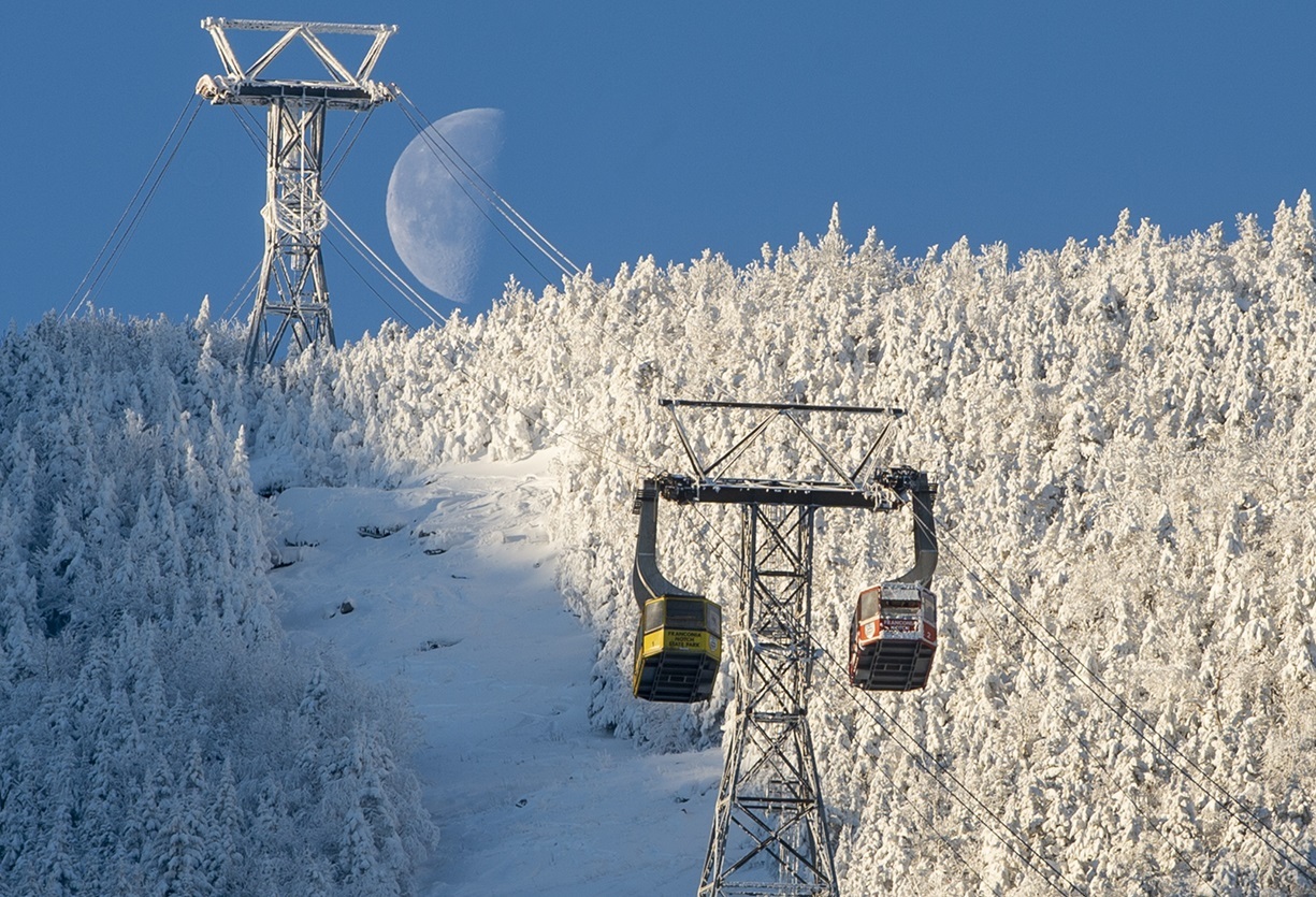
It appears that the Tram is set to retire within this year and that its replacement will be coming "in the next few years" meaning that skiers and riders will be without the Tram for a few ski seasons. LiftBlog reports that the New Hampshire Legislature has earmarked $27.2 million towards its replacement, but more funding is needed.
 

2Planker

Well-known member
Joined
May 16, 2007
Messages
1,738
Points
113
Location
MWV, NH


It appears that the Tram is set to retire within this year and that its replacement will be coming "in the next few years" meaning that skiers and riders will be without the Tram for a few ski seasons. LiftBlog reports that the New Hampshire Legislature has earmarked $27.2 million towards its replacement, but more funding is needed.
That would barely pay for a HSQ...
Prob need more like 100M
 

deadheadskier

Moderator
Staff member
Moderator
Joined
Mar 6, 2005
Messages
28,693
Points
113
Location
Southeast NH
Any major maintenance on the Peabody this summer? That thing has had quite a few down days in recent years. No Peabody and no Tram and it's pointless to even go there.
 

2Planker

Well-known member
Joined
May 16, 2007
Messages
1,738
Points
113
Location
MWV, NH
Any major maintenance on the Peabody this summer? That thing has had quite a few down days in recent years. No Peabody and no Tram and it's pointless to even go there.
Freebie for me Mon-Fri BUT YES Peabody will be all you get this season.
Tough to pay full price for that.
 

thebigo

Well-known member
Joined
May 15, 2005
Messages
2,098
Points
113
Location
NH seacoast
shocked this was announced after pass sales, it feels like Jace forcing the issue. starting everyday at mittersill, I rode the tram maybe 3X last year, closure will have minimal impact on my experience but I can imagine some furious pass holders. also feels like shuttle service should have been part of the announcement.

I rode up with the lifts manager late season, he mentioned a seven figure maintenance project on peabody due to age. dont remember if it was scheduled for this summer or next. think he said an electronics overhaul?

wonder how they are going to stock cafe 4080? Between me and my kids, I will save a fortune next season if there is no draft beer and cinnamon buns at the top.
 
Top