• Welcome to AlpineZone, the largest online community of skiers and snowboarders in the Northeast!

    You may have to REGISTER before you can post. Registering is FREE, gets rid of the majority of advertisements, and lets you participate in giveaways and other AlpineZone events!

ALPINEZONE SUMMIT at SUGARLOAF: March 26-28, 2010

Greg

Moderator
Staff member
Moderator
Joined
Jul 1, 2001
Messages
31,154
Points
0
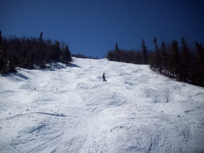
This is for elevation:

Tonight: Rain before 2am, then snow. Low around 26. Northeast wind between 15 and 18 mph. Chance of precipitation is 100%. Total nighttime snow accumulation of 1 to 3 inches possible.

Wednesday: Snow showers. High near 29. Very windy, with a north wind 21 to 24 mph increasing to between 40 and 43 mph. Winds could gust as high as 55 mph. Chance of precipitation is 80%. New snow accumulation of 2 to 4 inches possible.

Wednesday Night: A slight chance of snow showers before 2am. Cloudy, then gradually becoming partly cloudy, with a low around 19. Wind chill values as low as -1. Very windy, with a northwest wind between 37 and 47 mph, with gusts as high as 60 mph. Chance of precipitation is 20%.

Thursday: A slight chance of rain and snow showers after 2pm. Partly cloudy, with a high near 42. Wind chill values as low as zero. Breezy, with a west wind between 18 and 25 mph. Chance of precipitation is 20%.

Thursday Night: A slight chance of rain and snow showers before 8pm, then a chance of snow showers. Mostly cloudy, with a low around 9. Breezy, with a west wind between 18 and 24 mph. Chance of precipitation is 30%.

Friday: A slight chance of snow showers before 2pm. Mostly cloudy, with a high near 14. Chance of precipitation is 20%.

Friday Night: Mostly clear, with a low around -3.

Saturday: Mostly sunny, with a high near 26.

Saturday Night: Partly cloudy, with a low around 6.

Sunday: Partly sunny, with a high near 34.

Looking quite a bit less horriblle. Look at those winds Wednesday night! :-o
 

wa-loaf

Well-known member
Joined
Jan 7, 2007
Messages
15,109
Points
48
Location
Mordor
That is what I am talking about! Let's get some snow on top of the ice. Dust on crust, baby! :eek:

:lol:

Maybe some of it will blow into the glades ...

any reports from today?

how bad did the mountain get hit with niar?

sleet and freezing rain today. no damage to the base, but it's prob going to set up good. Good weekend to test out the Progressors ...
 

wa-loaf

Well-known member
Joined
Jan 7, 2007
Messages
15,109
Points
48
Location
Mordor
Maybe they can add some NASTAR gates to the bump course on Winters Way? :lol:
 

snowmonster

New member
Joined
Jan 2, 2006
Messages
4,066
Points
0
Location
In my mind, northern New England
I think this our goal:
The+Hangover+Wallpaper.jpg


Later Snowmonster can jump out of a trunk and beat us up with a tire iron.

Ha! I knew that tire iron would come in handy someday. But, I was thinking more along the lines of this:

AnimalHouseBigPic.jpg


Assume the position.
 

severine

New member
Joined
Feb 7, 2004
Messages
12,367
Points
0
Location
CT
Website
poetinthepantry.com
any reports from today?

how bad did the mountain get hit with niar?

My Diva informant has said they got about 4" on top of wet base--that's going to freeze solid for this weekend. She's confident that they'll groom out the mountain well with the cold temps, but that the mogul runs will be potentially hazardous.

Should be some fast bump runs for you guys! ;)

ETA: from Sugarloaf's Facebook page this morning:
Update: snow's in great shape from the fresh 4", we are however doing some work to get lifts going this morning. Due to some icing from yeseterday's storm, lift mechanics are banging ice off of Super Quad and then will move on to Spillway and T-Bar. We don't anticipate King Pine, Timberline or Whiffletree opening but ...will keep you up to date on the Trails and Lifts Page.
 

ethan

Industry Rep
Industry Rep
Joined
Sep 8, 2008
Messages
6
Points
0
Location
Sugarloaf
It was a mixed bag yesterday but turned to all snow overnight. About three inches at the base and probably 4-5 up at elevation. Here are a few photos from the base this morning.

25853_379311086878_61554966878_4278805_2869026_n.jpg


25853_379311096878_61554966878_4278807_7963645_n.jpg


25853_379311091878_61554966878_4278806_1628930_n.jpg


Ethan
 

Greg

Moderator
Staff member
Moderator
Joined
Jul 1, 2001
Messages
31,154
Points
0
Today: Snow showers, mainly before 2pm. High near 26. Blustery, with a northwest wind between 15 and 20 mph. Chance of precipitation is 80%. Total daytime snow accumulation of 2 to 4 inches possible.

Tonight: A chance of snow showers before 8pm. Partly cloudy, with a low around 14. Wind chill values as low as -4. Blustery, with a northwest wind between 14 and 22 mph. Chance of precipitation is 30%. New snow accumulation of less than a half inch possible.

Thursday: Mostly sunny, with a high near 43. Wind chill values as low as -5. Windy, with a west wind between 21 and 28 mph, with gusts as high as 41 mph.

Thursday Night: A chance of snow showers, mainly after 2am. Mostly cloudy, with a low around 7. Wind chill values as low as -14. Breezy, with a west wind between 17 and 23 mph. Chance of precipitation is 40%.

Friday: A chance of snow showers before 8am. Mostly cloudy, with a high near 15. Windy, with a northwest wind between 31 and 33 mph, with gusts as high as 50 mph. Chance of precipitation is 30%.

Friday Night: Partly cloudy and windy, with a low around -3.

Saturday: Mostly sunny, with a high near 29.

Saturday Night: Mostly cloudy, with a low around 7.

Sunday: Mostly cloudy, with a high near 38.

Looks pretty good. If this was late January, we'd be stoked for a sunny 29*F Saturday at the Loaf. Winds look rough Friday though.
 
Top