• Welcome to AlpineZone, the largest online community of skiers and snowboarders in the Northeast!

    You may have to REGISTER before you can post. Registering is FREE, gets rid of the majority of advertisements, and lets you participate in giveaways and other AlpineZone events!

Snow..coming ???

St. Bear

New member
Joined
Dec 22, 2008
Messages
2,946
Points
0
Location
Washington, NJ
Website
twitter.com
Pipeline was the best trail at MC. What in the world were they thinking??

I can only assume they got sick of blowing snow on a trail that only open a handful of times a year? I'm just curious what it looks like now. I can see them doing something like setting up a fence to block access.
 

Jcb890

Active member
Joined
Feb 25, 2015
Messages
1,741
Points
38
Location
Central MA
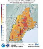
Which region are you looking for?

VT/Northern NY: https://www.weather.gov/btv/winter
NH/Western ME: https://www.weather.gov/gyx/winter
Southern VT/Eastern Catskills/Western MA: https://www.weather.gov/aly/winter

On any of those pages, you may have to click on "Probabilistic Snowfall" tab to see this graphic if it isn't on the main page.

As for S VT vs N VT with this storm, keep in mind that these graphics only represent totals through Thursday night at the moment. N VT in particular should see additional accumulations Friday into the weekend from upslope snow. For example one forecast says Sugarbush could see 15-30" total over a 3 day period. You won't see that in the NWS graphics at the moment, although the NWS forecast discussions do mention the additional snowfall after the main event and say the higher summits could see "significant" additional accumulations.
I just save favorites for each of the mountains and then go to each of those. So, I assume the Probabilistic Snowfall totals for regions probably are not available on those pages?
 

ss20

Well-known member
Joined
Jan 13, 2013
Messages
3,989
Points
113
Location
A minute from the Alta exit off the I-15!
I'm planning on heading back to Mountain Creek for Wednesday night powder turns. It'll be my first time there in 6 years, and looking at the trailmap, it looks like the double diamond Pipeline has been removed. I wonder if I can poach it at the end of the night after a foot of snow has fallen? I don't care so much about getting my passed pulled.

Slow down there...the full foot+ of snow won't be there till Thursday morning. No lights on Pipeline, so the latest you can poach it would be 6pm with daylight. By that time there's only gonna be 8" or so on the ground...on top of bare ground.

Not recommended...
 

cdskier

Well-known member
Joined
Mar 26, 2015
Messages
6,761
Points
113
Location
NJ
I just save favorites for each of the mountains and then go to each of those. So, I assume the Probabilistic Snowfall totals for regions probably are not available on those pages?

Yea, I don't think specific location pages have them from what I remember. You have to go to the "Winter" page from each NWS office to get to the graphics for that office's coverage area.
 

St. Bear

New member
Joined
Dec 22, 2008
Messages
2,946
Points
0
Location
Washington, NJ
Website
twitter.com
Slow down there...the full foot+ of snow won't be there till Thursday morning. No lights on Pipeline, so the latest you can poach it would be 6pm with daylight. By that time there's only gonna be 8" or so on the ground...on top of bare ground.

Not recommended...

I mean, I wasn't just going to bomb it sight unseen. Just a little wishful thinking.
 

Jcb890

Active member
Joined
Feb 25, 2015
Messages
1,741
Points
38
Location
Central MA
Yea, I don't think specific location pages have them from what I remember. You have to go to the "Winter" page from each NWS office to get to the graphics for that office's coverage area.
Ah, I figured that might be my issue. So I have to go to the weather centers instead... which I'm not still having an issue finding. Man, I suck. Looks like you guys will just have to keep posting updates for me. :lol:
 

Glenn

Active member
Joined
Oct 1, 2008
Messages
7,691
Points
38
Location
CT & VT
Since you like it, here's the VT version.


EDIT: That said, IMO, folks are going to be bumping these numbers up a touch this afternoon.

That's interesting how the Burlington NWS Office posted totals for the entire state. Do they typically do that? Albany sticks to just the counties their office covers on the total maps.
 

cdskier

Well-known member
Joined
Mar 26, 2015
Messages
6,761
Points
113
Location
NJ
That's interesting how the Burlington NWS Office posted totals for the entire state. Do they typically do that? Albany sticks to just the counties their office covers on the total maps.

Seems to be something they only started doing more recently from what I recall. I swear it wasn't too long ago that they only had the part of the state that the Burlington NWS office covers in their maps. I could be mis-remembering though.
 

BenedictGomez

Well-known member
Joined
Jan 26, 2011
Messages
12,556
Points
113
Location
Wasatch Back
Potential good news, or at least an incremental positive.

The "real world" cold air aloft is currently colder than the models have it. Might need to go something like 12:1 instead of default.
 

ss20

Well-known member
Joined
Jan 13, 2013
Messages
3,989
Points
113
Location
A minute from the Alta exit off the I-15!
So if this pans out the Catskills will total 5 feet of snow in a week.

I'm thinking Windham tomorrow. I was going to do Mount Snow but models consistently showing them picking up 4" if they're lucky by 4pm compared to the Catskills which are gonna get 10"+ it seems.

Debating between Stratton and Magic Friday. I've skied Magic on days where it snows and it's awesome. My fear is that the-day-after-the-storm it's a madhouse. I went to Stratton a couple days after a storm Friday February 9th and things that you wouldn't expect a Stratton skier to gravitate towards were still pretty fresh. Stuff that the Magic clientele flocks to.
 

bdfreetuna

New member
Joined
Jan 12, 2012
Messages
4,300
Points
0
Location
keep the faith
"Expected Snowfall" maps are for nerds. Real men of adventure make plans based on the Highest Amount 10% forecasts. Or NAM 3k CONUS whichever is higher.
 

Glenn

Active member
Joined
Oct 1, 2008
Messages
7,691
Points
38
Location
CT & VT
This is going to be a fun one to watch on the webcams tomorrow. Provided anything falls during the daylight hours.
 

Jcb890

Active member
Joined
Feb 25, 2015
Messages
1,741
Points
38
Location
Central MA
I'm thinking Windham tomorrow. I was going to do Mount Snow but models consistently showing them picking up 4" if they're lucky by 4pm compared to the Catskills which are gonna get 10"+ it seems.

Debating between Stratton and Magic Friday. I've skied Magic on days where it snows and it's awesome. My fear is that the-day-after-the-storm it's a madhouse. I went to Stratton a couple days after a storm Friday February 9th and things that you wouldn't expect a Stratton skier to gravitate towards were still pretty fresh. Stuff that the Magic clientele flocks to.
Going tomorrow and Friday, but not Thursday? Thursday seems like it would be the best day to get out there with most of the snow already fallen and a couple more inches still piling up.
 

Glenn

Active member
Joined
Oct 1, 2008
Messages
7,691
Points
38
Location
CT & VT
NWS Albany updated their Winter Storm Warning

Holy....

WHAT...Heavy snow expected. Total snow accumulations of 12 to 18 inches, with localized amounts up to 24 inches in the Berkshires
and Green Mountains, are expected.
 
Top