Via Famous Internet Skier's Facebook page:
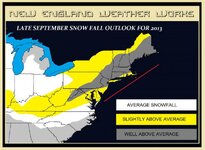
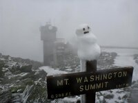
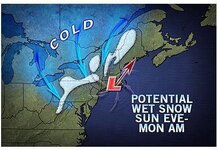
Over the next week the N/E is going to have two shots at seeing some flakes. The first chance will come Sunday night into monday morning. A trough swinging down and through the great lakes out of Canada will push east over our area saturday night, with rain clearing the area sunday morning. In the wake of that front, cool air will build in. h85 temps on the GFS have remained steady at -1 to -3 C. Therefore, any embedded low level moisture on the N/W flow will produce upslope precip in the form of light flakes. The air mass is not too wet so we're only talking about flakes in the air or at best a coating above 3000 feet. Notably the NAM holds the core of the cold air back to the west and blunts its progression across the north country on sunday. Looks a bit odd to me, so I'm going with the GFS.
The next threat comes wednesday night into thursday. A lobe of cold air will sink down behind a cold front pushing south out of canada. The 0z gfs today is much warmer than previous runs which had cold air at h85 all the way down through the catskills. REgardless, I like these two shots right now and think the are worthy of my close attention.
- Lionel.


