polski
New member
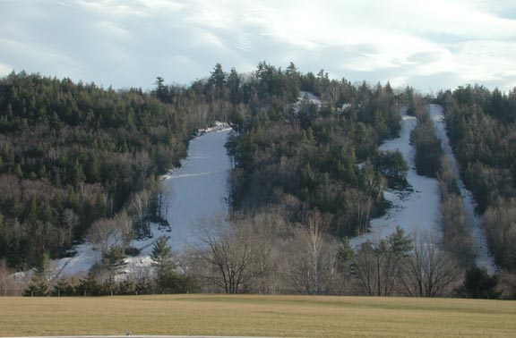
On our way to Ragged yesterday we didn't take the New Canada Rd. shortcut at the end and instead took Rte 4 N all the way into Danbury, and across the valley to our left (roughly due west of Ragged) I noticed what sure looked like a small ski area. At least 2-3 trails were visible, there was some sort of lift -- surface, I'm almost certain -- and at 8 a.m. there even were lights on one trail, to looker's right of the lift. At just quick glance from a distance it appeared to have decent pitch and maybe 200-300 feet of visible vertical.
On our return trip yesterday we did take the shortcut so missed getting a second look. I've looked at Mapquest and Google maps with satellite and terrain views and wasn't able to pinpoint the location
Anyone know what this is? Or was it an apparition :smile:
On our return trip yesterday we did take the shortcut so missed getting a second look. I've looked at Mapquest and Google maps with satellite and terrain views and wasn't able to pinpoint the location
Anyone know what this is? Or was it an apparition :smile: