LiquidFeet
Member
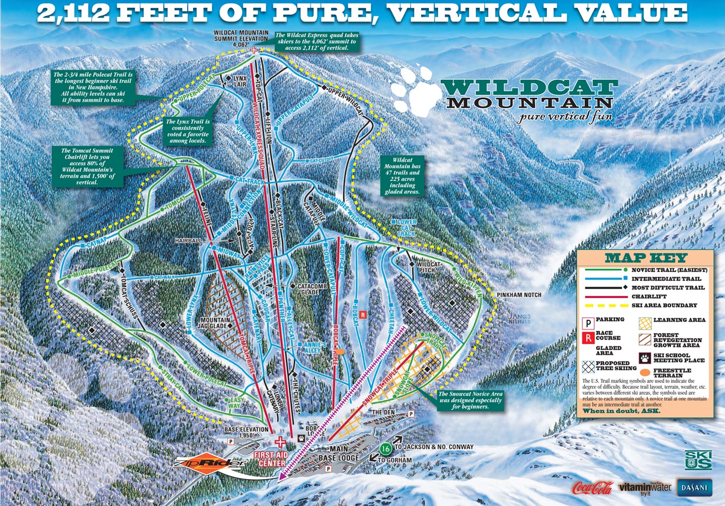
I just read the following on Wildcat's website. Anyone know anything about whether this means anything beyond cleaning up natural debris? Management says it is "improving" tree skiing at both mountains.
"Wildcat Mountain has also continued for a second year to work closely with the U.S. Forest Service to improve and maintain the approved glade and tree skiing areas during the off-season. Peak Resorts is committed to the tree skiing at Wildcat Mountain and Attitash Mountain Resort and is improving areas responsibly and consistent with the U.S. Forest Service."
"Wildcat Mountain has also continued for a second year to work closely with the U.S. Forest Service to improve and maintain the approved glade and tree skiing areas during the off-season. Peak Resorts is committed to the tree skiing at Wildcat Mountain and Attitash Mountain Resort and is improving areas responsibly and consistent with the U.S. Forest Service."
")