• Welcome to AlpineZone, the largest online community of skiers and snowboarders in the Northeast!

    You may have to REGISTER before you can post. Registering is FREE, gets rid of the majority of advertisements, and lets you participate in giveaways and other AlpineZone events!

Incoming!!!!!

ALLSKIING

Moderator
Staff member
Moderator
Joined
Jan 6, 2005
Messages
6,971
Points
48
Location
East Setauket,NY/Killington,VT
JB tweeted the cfsv2 this morning showing below avg temps for the next 45 days. Seeing as we are going into a warm up now says to me that there just might be some good cold air in the pipeline coming this way. (fingers crossed)

Alex

Lake Hopatcong, NJ

Looks like starting wed night. Hope it holds all season!

sent from my S4
 

BenedictGomez

Well-known member
Joined
Jan 26, 2011
Messages
12,546
Points
113
Location
Wasatch Back
Here's another incoming long-range prediction for the northeast, this one from some local amateur (but trained) mets that cover e.Pa and w.NJ.

s3yi.png
 

billski

Active member
Joined
Feb 22, 2005
Messages
16,207
Points
38
Location
North Reading, Mass.
Website
ski.iabsi.com
Yeah, but this weekend, and today in particular were pretty pitiful. I was sweating up a storm raking leaves yesterday. I'm usually freezing my butt off. But I'm with Benedict, it's time to rock. If the moisture content stays high, elevation conquers all evil! Hoping to get some turns in the week before xmas and some time up at Magic.
 

dlague

Active member
Joined
Nov 7, 2012
Messages
8,792
Points
36
Location
CS, Colorado
Well the first two snowy forecasts that were showing accumulation have been a bust so far - so I will take the wait and see from now on! Yes we will take the gift when we get it!

Jay Peak had a great spell of powder in November!
 

ScottySkis

Well-known member
Joined
Jan 16, 2011
Messages
12,294
Points
48
Location
Middletown NY
http://www.liveweatherblogs.com/ind...discussion&groupid=8&topicid=56150&Itemid=179

These guys think next weeks T day storm will be coastal and good for Maine Mtns and a little for the Whites.

Good Morning

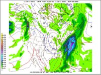
The models are sliding into a Nor'easter solution and we are getting into a locked nor'easter mode but the wild card still remains on the back end of this storm for some snow. The GFS has come around to the nor'easter idea on the last two runs and the other models are on board too.

HERE IS A QUICK SCORECARD ON THE LATEST RUNS...

NAM: Not in range yet...we'll get a look about 9:30am
GFS: Wet with some snow on the back end esp. N & W of I-95 for Philadelphia Baltimore Allentown Reading NYC Metro.
EURO: Wet and Wild and like the GFS has some snow on the back end.
Canadian: Just like the Euro and GFS it has rain but not as cold for snow on the back end.

The run the last 12 hours has put the big three models in close agreement for a nor'easter and it will not take much to move the track 50 miles to get a sweeter spot for snow. The fact the models are all this close on this run this far out is quite interesting at this point.

The Smaller details of it all...

The track is a good one and oh my if this was a few weeks later or in January WOW. The ocean is still mild and it's late November not late December. The storm itself is going to bring some travel problems starting Monday in Atlanta (Delta) and roll north for Tuesday and Wednesday. If you are flying or have family and friends flying this storm will cause delays we are certain of that. The delays will be from heavy rain, wind, low visibility, fog, and potential snow on Wednesday and even early Thursday.
New England may have some real problems if the colder trend continues and a major snowstorm could be in the works up there. This is a big storm in size and precip. so all eyes are on it as we approach the busiest travel day of the year. We'll have more updates throughtout the day. The NAM will give some insight to a few things at about 9:30am
 

ScottySkis

Well-known member
Joined
Jan 16, 2011
Messages
12,294
Points
48
Location
Middletown NY
https://www.facebook.com/HVWX1?ref=stream
Storm Update with Images-
These are what my Mid Hudson Valley weather is saying about next week storm.
So as you all know, we have been eluding to a storm potential for about 3-4 days now, but we have not went into very much detail till now. The reasons being that it was to far in the long range, it occurs during a high impact travel/holiday period and over the last few days we lacked what we call model consistency. Long story short, no reason to cause hype about a storm that was a week away that could have large implications on peoples plans when there was very little consistency amongst the forecast models.

So what has changed? Well we are now 5 days away, we have three major models all aligned with the fact that there will be a storm along the coast around the same time, and at only 5 days away we have reached the time frame that most people could use this type of early warning to factor into their plans. In the 3 images attached we have the GFS Model the European model and the Canadian Model they are showing accumulated snowfall from the storm, notice the similarities? But there are also some differences, the European model has the heaviest snowfall over our region and the other two models have that band to our North. Reason why its important to highlight those subtle differences is because it shows that the exact track this system eventually takes can have a large impact on the outcome.
Examples, a track very close to the coast will cause warm air to surge nland and up the Hudson River Valley causing most of the precip to fall as rain that may end as snow as the storm passes and colder air rushes in behind it, while a track further offshore would lead to the cold air not being eroded and most of the precip to fall as snow i.e. the European model. Or the storm could track to far off shore and only graze the southern areas with some precip. We will have some very cold air attempting to rush into the area around the same time this storm is moving along the coast, the way these two elements interact with each other can have a significant impact on the outcome.
So what are the facts? At this point it is increasingly likely that a powerful storm will move up the coast between Tue Pm-Thur AM. No matter what type of precip falls , it is still likely that heavy rain and gusty winds along the coast will impact some of the major airports. At 5 days away there are details that will continue to be ironed out as we get closer, such as where does the rain/snow line develop, what is the final track, how much cold air works into the system and how strong does the system get. At this point we share this information simply so it can become a part of your plans for next week. Yes the models show significant snowfall for part of our region, NO these models at 5 days out should not be taken verbatim, they are simply used to look for trends at this point,
As always we will be updating frequently over the next fews days and keeping you all aware of any changes that occur, and please when sharing this information either verbally of through social media be conscious that we are NOT forecasting a major snowstorm for next week, we are highlight the fact that there will likely be a storm, but its exact impacts are to be determined as we get closer.
 
Top