reefer
Well-known member
Sign me up! Thanks so much for the offer! Keith.
Welcome to AlpineZone, the largest online community of skiers and snowboarders in the Northeast!
You may have to REGISTER before you can post. Registering is FREE, gets rid of the majority of advertisements, and lets you participate in giveaways and other AlpineZone events!
I moved this to T&E and retitled to "MRV Reunion - April 4-6".
Michael - what's the process for those looking to book rooms?

Just give me a call. Go the website below for the number. If you've got someone you'd prefer to room with, let me know.
Which reminds me. I'd better, uhm, mention this little "offer" to my wife before anyone calls.
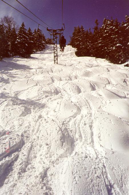
I will be in the MRV from Thurs. night April 5 thru Sun. April 8. I'll be staying at my condo off the SB Access Road so I won't need lodging from the very generous KingM (this time). Hopefully, I'll be able to ski with some AZers during this time, however. I'm planning on hitting both MRG & LP that weekend.
Greg: Is the planned trip really from April 4 to 6 or will it extend into the weekend?
I'm coming up the night of the 5th, skiing MRG on the 6th and heading home from there. Let me know where you'll be on the 6th.
At this point, I'm planning on hitting MRG on the 6th as well. We should hook up for some turns, along with anyone else who will be there (2knees?).
.LONG TERM /SATURDAY THROUGH WEDNESDAY/...
LONG TERM FCST CONCERN WL BE TIMING AND EVOLUTION OF DEVELOPING
MID/UPPER LVL TROF ACRS THE CENTRAL GREAT LAKES INTO THE NE CONUS
LATE TUES INTO THURS...ALONG WITH THE ASSOCIATED SFC LOW TRACK.
FIRST...STRONG MID/UPPER LVL RIDGE ACRS EASTERN SEABOARD WL SLOWLY
BREAK DOWN AS CENTRAL PLAINS SYSTEM LIFTS INTO THE WESTERN GREAT
LAKES BY 12Z SUNDAY. THE 00Z ENSEMBLES AND LATEST 12Z GFS SHOW BAND
OF DEVELOPING MOISTURE/LIFT ASSOCIATED WITH 5H VORT AND STRONG
LOW/MID LVL WAA MOVING ACRS OUR CWA LATE SUNDAY INTO SUNDAY NITE. WL
CONT WITH PREVIOUS FCSTER THINKING AND UP THE POPS TO LIKELY...BUT
ONLY EXPECTING A 0.25" OR LESS QPF. THIS WEAK SYSTEM CONTS TO LIFT
INTO CANADA ON MONDAY...WHILE NEXT SIGNIFICANT MID/UPPER LVL TROF
RE-ORGANIZES ACRS THE INTER-MOUNTAIN WEST AND ENHANCES SFC LOW PRES
ON THE LEE SIDE OF THE ROCKIES. THE DEVELOPING DOWN STREAM RIDGE
ACRS THE GREAT LAKES INTO THE NE CONUS WL PROVIDE CWA WITH SOME DRY
AND NEAR NORMAL TEMPS FOR MONDAY INTO TUES. PROGGED 85H TEMPS WARM
BTWN 6 AND 8C BY MONDAY...AS OUR FA IS IN THE WARM SECTOR. IF WE CAN
SEE SOME SUN AND MIXING OCCURS...TEMPS WL BE WELL INTO THE 50S TO
NEAR 60F...BEFORE MUCH COOLER AIR ARRIVES FOR MID TO LATE WEEK.
BY MID WEEK NORTHERN STREAM S/W ENERGY WL DEEPEN MID/UPPER LVL TROF
ACRS THE NORTHERN PLAINS AS INITIAL SFC LOW PRES FROM THE HIGH
PLAINS EJECTS INTO THE CENTRAL GREAT LAKES. HOWEVER...STRONG
SOUTHERN STREAM ENERGY...ALONG WITH ANOTHER NORTHERN STREAM VORT WL
PHASE TOGETHER TO ENHANCE SECONDARY COASTAL DEVELOPMENT ACRS THE MID
ATLANTIC STATES BY 00Z THURS. THIS SYSTEM WL HAVE TO BE WATCHED
CLOSELY FOR THE POTENTIAL FOR A LATE SEASON SNOW EVENT ACRS OUR CWA.
ONE THING IS FOR SURE...ANOTHER SHOT OF BELOW NORMAL TEMPS WL OVER
SPREAD THE FA AS MID/UPPER LVL TROF DEEPENS ACRS THE NE CONUS AND
CYCLONIC CIRCULATION ADVECTS UNSEASONABLY COOL TEMPS INTO THE
REGION. CRNT ENSEMBLES DATA AND LATEST 12Z GFS SHOW PROGGED 85H
TEMPS BTWN -12 AND -16C BY THE MID/LATE NEXT WEEK...WHICH SUPPORT
HIGHS IN THE U20S TO M30S.
Don't jinx it bud....................... but I'm right with you on this one. I just called Michael (thanks KingM) to reserve my spot. I'll be at the Bush with my friend Chris in a blizzard on Thursday, then at Mad River Friday.