-
Welcome to AlpineZone, the largest online community of skiers and snowboarders in the Northeast!
You may have to REGISTER before you can post. Registering is FREE, gets rid of the majority of advertisements, and lets you participate in giveaways and other AlpineZone events!
You are using an out of date browser. It may not display this or other websites correctly.
You should upgrade or use an alternative browser.
You should upgrade or use an alternative browser.
NWS 2016 / 2017 Winter forecast!
- Thread starter ALLSKIING
- Start date
Rowsdower
Member
Looks like a visit to Happyland is in order.
BenedictGomez
Well-known member
Not Sure
Well-known member
ELK WOULD BE THE BEST PLACE ON THE PLANET FOR SNOWFALL.. Looks like Elk, Blue, Camelback, Jack Frost, Platty, Belleayre and Minnewaska would be the jackpot.. Maybe VVGG also.(mountain creek for your young people)
1+ I had a knee deep run on Lakawanna this december when they first dropped the rope. Still sore about them not dropping ropes elsewhere 8" everywhere else . Two feet would be awesome .
thebigo
Well-known member
Tin
Active member
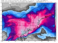
Sweet clown maps. Too bad it is exiting stage right.
Tin
Active member
BenedictGomez
Well-known member
12z runs
GFS - Good run, stays put, still has blizzard
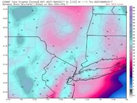
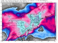
Canadian - Great run, moves a bit west, which is very good news, still not a great storm for ski country, but trend west toward other models is good news.
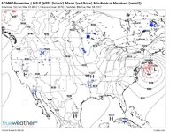
Euro - moves way far east, which is horrible for everyone and kills ski country hopes, but this is just an op run, so no need to jump off a cliff unless the ensemble run looks the same, and I doubt it will
Tin
Active member
12z runs
GFS - Good run, stays put, still has blizzard
Canadian - Great run, moves a bit west, which is very good news, still not a great storm for ski country, but trend west toward other models is good news.
Euro - moves way far east, which is horrible for everyone and kills ski country hopes, but this is just an op run, so no need to jump off a cliff unless the ensemble run looks the same, and I doubt it will
Still 72 hours out and the systems are not even on our continent, a shit load can happen. Majority of EURO ensembles put it west of the forecast, trash the 12z run. Ukie kept it west. I'm still planning on driving up Tuesday am.
thebigo
Well-known member
Tin
Active member
NAM a little quicker, not exactly a tick east though. Similar course.
Subtract ~30% of the total liquid then multiply by 13.

Subtract ~30% of the total liquid then multiply by 13.

Last edited:
Tin
Active member
Was just speaking to a meteorologist from Accuweather who said models are showing it moving further east.
When I asked him what that meant for the White Mountains he mentioned more snow unless it tracks too Far East.
If they work for Accuweather they are a dumbass and one Euro over-correction run = "models bringing it east" demonstrates that. LOL
The Euro has been absolute shit this year and in previous years. If the 0z GFS goes east then I will agree.
NWS is disregarding "models moving it east" and posting blizzard watches along the shore, and NWS Burlington going with a widespread 12-18.
Last edited:
Tin
Active member
Then why are you not broadcasting for a major network of your so talented? You remind me of all the wannabe engineers out there. They think they know science.
Because I'm an engineer. It is impossible to "know science" if you don't understand the mathematics that underlies everything science and its tools attempts to explain/measure. Look at any technology in science; whether it is medical imaging, anything astro, or met models, it is all math and physics. Every pretty image you see that describes/attempts to predict a event/phenomena is based in numbers basic rules of physics. Fuck science, acquire math skillz and general principals.
Last edited:
Because I'm an engineer.
I hope you have a BSME laying around the house then.
I'm going to call you out. I say it tracks further east and mass gets the heaviest.
thebigo
Well-known member
I hope you have a BSME laying around the house then.
I'm going to call you out. I say it tracks further east and mass gets the heaviest.
Not one for a pissing contest but please name the met from accuweather and the model. I am not a met, just a hobby of mine but my understanding is that the energies will not be fully sampled until tonight's 0z. Anybody, claiming to know the outcome is misrepresenting educated opinion as fact. Oh and as if it mattered, my bsme is somewhere in the attic or maybe the basement, next to my masters degree.
Last edited:
Tin
Active member
I hope you have a BSME laying around the house then.
I'm going to call you out. I say it tracks further east and mass gets the heaviest.
Eastern Mass has been the bull's eye for the actual system QPF, it's just a matter of ratios and if it stays frozen. The wrap around will crank for the northern spine and Whites until Thursday morning and add an extra 8-12"+ ontop of storm totals.
Not one for a pissing contest but please name the met from accuweather. I am not a met, just a hobby of mine but my understanding is that the energies will not be fully sampled until tonight's 0z. Anybody, claiming to know the outcome is misrepresenting educated opinion as fact. Oh and as if it mattered, my bsme is somewhere in the attick or maybe the basement, next to my masters degree.
He doesn't realize I'm completely fucking with him. But no one should ever cite accuweather, TWC, and 90% of Twitter mets. And yes, the factors have really yet to even reach our continent.
Similar threads
- Replies
- 32
- Views
- 7K
- Replies
- 5
- Views
- 4K
- Replies
- 9
- Views
- 4K


