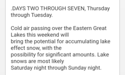
Will it ever snow this winter?!! I live in ne Ohio and we had one storm of 24” that lasted a week and then gone and not a flake since. I ski in north western ny and they usually have way more than here and they have had even less snow there. Tired of skiing on stale ass man made snow lol.
-
Welcome to AlpineZone, the largest online community of skiers and snowboarders in the Northeast!
You may have to REGISTER before you can post. Registering is FREE, gets rid of the majority of advertisements, and lets you participate in giveaways and other AlpineZone events!
You are using an out of date browser. It may not display this or other websites correctly.
You should upgrade or use an alternative browser.
You should upgrade or use an alternative browser.
Where is the snow
- Thread starter Smitty244
- Start date
Hastur
Well-known member
the PNW seems to be getting dumped on so far. But winter is still young.
Cornhead
Well-known member
- Joined
- Dec 4, 2010
- Messages
- 2,841
- Points
- 48
I feel your pain, I missed the one powder day this year at my local hill because there was 41" on my street. I couldn't escape my house for 2 days. I'm convinced lake effect from Erie and Ontario has decreased significantly over the last couple years. I enjoyed posting TR's from northern NY while NE was dry as a bone, been years. Hopefully this forecast happens, and hits a ski hill. Those lake effect storms are fickle, 3 ft in one spot, nothing a few miles away.
I feel your pain on the boredom of skiing the same man made trails over and over. At least my local hill, Greek Peak, is finally expanding terrain. Chair 5 is scheduled to open tomorrow, and Odyssey should be open now on the front side. I was beginning to feel like Bill Murray in Groundhog Day.

I feel your pain on the boredom of skiing the same man made trails over and over. At least my local hill, Greek Peak, is finally expanding terrain. Chair 5 is scheduled to open tomorrow, and Odyssey should be open now on the front side. I was beginning to feel like Bill Murray in Groundhog Day.
Last edited:
kingslug
Well-known member
Looks like its coming today and tomorrow to...a hill near you...
ScottySkis
Well-known member
...WINTER STORM WARNING IN EFFECT FOR EASTERN COLUMBIA COUNTY UNTIL 7 AM SATURDAY...
* WHAT...Heavy snow. Additional snow accumulations of up to two inches. Storm total snow of 5 to 11 inches with highest amounts above 800 feet.
* WHERE...Eastern Rensselaer and Eastern Columbia Counties.
* WHEN...Until 7 AM EST Saturday.
* IMPACTS...Travel could be very difficult. Snowfall rates may reach half inch to one inch per hour at times this evening, especially above 1500 feet in the Taconics and the southern Greens. Strong winds and moderate to heavy snow will likely reduce of visibilities and result in blowing snow.
— HVW Commentary —
A localized heavy snow event as a result of the departing low pressure system. The higher elevations of eastern Columbia County have seen a heavy wet snow for several hours. Snowfall amounts over 6” have been reported in the higher elevations near the NY/CT border. The futurecast map suggests only another inch or two possible in the NE parts of Columbia. Use extreme caution traveling tonight in the eastern half of Columbia county.
Similar threads
- Replies
- 2
- Views
- 5K
- Replies
- 9
- Views
- 4K
- Replies
- 2
- Views
- 4K
- Replies
- 34
- Views
- 17K