• Welcome to AlpineZone, the largest online community of skiers and snowboarders in the Northeast!

    You may have to REGISTER before you can post. Registering is FREE, gets rid of the majority of advertisements, and lets you participate in giveaways and other AlpineZone events!

The Official 12/30 Storm Discussion Thread

Bumpsis

Well-known member
Joined
Mar 25, 2004
Messages
1,090
Points
48
Location
Boston, MA
Looks like Fresh Poe for Sunday in the Poconos..
Hey Grilled,what's with the "Poe" word?? Looks like you're trying to coin to a new word for powder, but I don't get it. It just doesn't work, phonetically or otherwise. Is there some secret etymology that's involved? Why "Poe" and what's with the capitalization?
 
Joined
Aug 23, 2007
Messages
17,569
Points
0
Hey Grilled,what's with the "Poe" word?? Looks like you're trying to coin to a new word for powder, but I don't get it. It just doesn't work, phonetically or otherwise. Is there some secret etymology that's involved? Why "Poe" and what's with the capitalization?

I've been saying and skiing fresh Poe for years..it's way better than mad sweet and low..or mad applesauce..Fresh Poe is mad goldilocks..just right. Here's some more stoke I from the web about this upcoming storm..

This is a quote from phillyweather.com
In the snow areas north and west, the potential for 6" is possible, especially along the Route 222 corridor. Places like Allentown, Reading, Harrisburg, and the Poconos stand to do pretty well from this event. The Philadelphia suburbs may contend with sleet mixing in and the potential is there for 2-4" for Pottstown, Quakertown, Doylestown, and West Chester.


Woo Hoo..Channels 3, 6, and 10..are gonna be in Hog Heaven Sunday..Holla....and I'll be skiing Fresh Poe at Blue mountain the true mountain..It might be a double dip session that day..Early morning Fresh Cord..then go home and post on the internet..then a Late PM/evening session when the snow is dumping the hardest..Storm Skiing is the bomb deezy fo sheezy..Ya Heard..
 

Greg

Moderator
Staff member
Moderator
Joined
Jul 1, 2001
Messages
31,154
Points
0
Snow Advisory: 3-6" for Litchfield County

We have a Snow advisory for our area:

Snow Advisory In Effect From 7 PM Sunday To 6 AM EST Monday...

The National Weather Service In Albany Has Issued A Snow Advisory... Which Is In Effect From 7 PM Sunday To 6 AM EST Monday For Ulster... Dutchess... And Litchfield Counties.

A Moderate Snowfall Of 3 To 6 Inches Is Expected Over The Advisory Area Sunday Night Into Monday Morning. Low Pressure Will Quickly Move Northeast From Near The Delmarva Region Sunday Evening... To Southeast Of Cape Cod By Daybreak On Monday. The Snow Is Expected To Move Into The Southeastern Catskills... Mid Hudson Valley... And Litchfield Hills Sunday Evening. Snowfall Rates May Briefly Reach An Inch An Hour Early Monday Morning. The Snowfall Will Taper To Scattered Snow Showers And Flurries Late Monday Morning.

A Snow Advisory Means That Periods Of Snow Will Cause Primarily Travel Difficulties. Be Prepared For Snow Covered Roads And Limited Visibilities... And Use Caution While Driving.
 

loafer89

New member
Joined
Apr 21, 2004
Messages
3,978
Points
0
Location
Enfield, C.T
NOAA is predicting 4-7" for my county with possible 8" amounts in the higher elevations. Lucky me.
 

loafer89

New member
Joined
Apr 21, 2004
Messages
3,978
Points
0
Location
Enfield, C.T
NOAA now says 8" + likely for NE Connecticut. What good does it do for us, we haven't any sking in my part of the state.

We are leaving Saddleback by 1pm to avoid driving home in any bad weather.
 

adamti91

New member
Joined
Jan 10, 2007
Messages
496
Points
0
Location
eugene oregon
WRGB_SNOWBAND1


Finally the Catskills will get some snow again...
 

powderfreak

New member
Joined
Jan 9, 2007
Messages
256
Points
0
Summary:

Developing winter storm in the southeastern U.S. will move up along the
Atlantic coast spreading a shield of snow across the entire northeast
tonight and Monday morning. Heaviest snowfall accumulations are expected to
be across the Catskills, Greater Albany area, Berkshires, and a large area
of central New England where 5-9" is expected. Lighter snows are expected
across northern New England and the Adirondacks where 3-6" are expected.

Then, on Tuesday a robust area of low pressure will track across New England
and all signs are pointing to an incredible amount of Atlantic moisture
getting thrown back into central and northern New England. This event
should spread a widespread 5-10" across the northern half of the Green
Mountains, and all of the White Mountains by Wednesday morning. A foot is
not out of the question across NVT, NNH, and ME on Tuesday.

Discussion:

Rapidly changing weather situation on our hand with not one, but two systems
that could total 1.5 feet in some areas between 12am Monday and 12pm
Wednesday. The system for tonight is developing nicely in the southeast and
models are still playing catch up on the moisture with this. 12z NAM has
.5-.75" of QPF across most of Vermont except the far north. Models showing
signs of a very healthy system with incredible upper level divergence in RRQ
of 150kt+ jet streak. This divergence is causing a very nice satellite
presentation this morning and rapidly cooling cloud tops are spreading north
ahead of the system. Due to deep layer mechanics with this system, I feel
more confident that we realize significant snow across southern/central New
England with moderate snow accumulations across the north. Maximum vertical
velocities across the area are located in the area of best dendrite snow
growth at -12C to -16C temperatures. Temperatures are mild now but once
this rolls in we'll fall into the upper 20's with good dendrites falling
from the sky at the heart of the event with rates exceeding 1"/hr across SVT
and adjacent areas.

Then...well, I'll let this morning's Hydro Prediction Center Heavy Snowfall
discussion fill you in on the Tues into Wed event. I like the catch
phrases in here that make skiers and riders go crazy, like "extremely heavy
snowfall" and "tremendous surge of Atlantic moisture."

NEW ENGLAND/GRT LAKES...
THE SHORT WAVE DYNAMICS FROM THE PAC WILL ROLL INTO THE PLAINS/MS
VLY DAY 2 BEFORE BEGINNING TO PARTIALLY PHASE WITH A DIGGING NRN
STREAM SHORT WAVE ARRIVING INTO THE UPR MS VLY ON TUES. THE
RESULTANT... DESPITE SOME CONSIDERATE MODEL SPREAD AND
UNCERTAINTY... WILL BE A DEEPENING SURFACE CYCLONE OVER SLIDING
THROUGH NEW ENGLAND AND A TREMENDOUS SURGE OF ATLANTIC MOISTURE
ARRIVING INTO NEW ENGLAND. MOST OF THE GUIDANCE DEPICT SOMETHING
SIMILAR TO THIS IDEA BUT ARE REALLY WAVERING ON THE ACT AXIS OF LL
MOISTURE SURGING INTO NEW ENGLAND. HPC ENDED UP FOLLOWING A BLEND
OF THE 21Z SREF MEAN AND EARLIER 12Z ECMWF OVER THE 00Z NAM/GFS
WHICH WOULD EASILY PRODUCE EXTREMELY HEAVY SNOW FROM ME THROUGH
NH/VT INTO UPSTATE NY WITH HVY SNOWFALL LIKELY DOWNSTREAM OF THE
GRT LAKES. THE DEEP CYCLONIC FLOW WITH STRONG CAA WILL STREAM
ACROSS THE RELATIVELY WARM GRT LAKES FOR DECENT SNOWFALL AMOUNTS.
THE EXACT DETAILS ON THIS IMPENDING STORM SYSTEM WILL BE PLAYED
OUT OVER THE NEXT DAY OR TWO BUT SOMEBODY ACROSS NRN NEW ENGLAND
WILL LIKELY SEE A FOOT OF SNOW ON TUES.

-Scott
 

Greg

Moderator
Staff member
Moderator
Joined
Jul 1, 2001
Messages
31,154
Points
0
Snowing lightly, 33.1*F and a dusting so far.
 

loafer89

New member
Joined
Apr 21, 2004
Messages
3,978
Points
0
Location
Enfield, C.T
It's dumping fast and furious here and 31F. It started snowing just after we crossed the MA/CT line in Union.

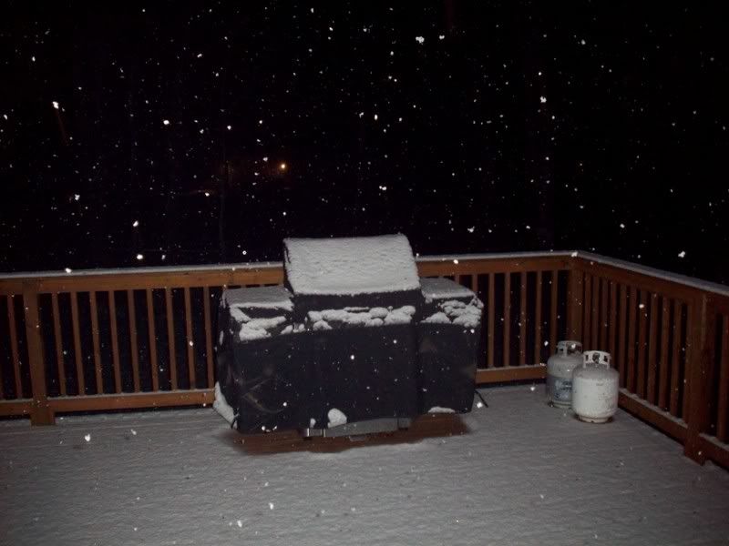
My deck @8:40pm with about 1" new:

Snow-1.jpg
 
Last edited:

WJenness

Active member
Joined
Oct 18, 2007
Messages
3,024
Points
38
Location
Lowell, MA
Snowing pretty decently here in Chelmsford, MA. Been snowing about a half hour or so.

Going to get my camera I got for Christmas, will post pic.

Note: Parked my car at 8:30, probably still warm enough to melt new snow.

-w
 
Last edited:

Greg

Moderator
Staff member
Moderator
Joined
Jul 1, 2001
Messages
31,154
Points
0
Bust!

About 2" of heavy wet slop here... :roll: :evil:
 
Top