• Welcome to AlpineZone, the largest online community of skiers and snowboarders in the Northeast!

    You may have to REGISTER before you can post. Registering is FREE, gets rid of the majority of advertisements, and lets you participate in giveaways and other AlpineZone events!

Safety of (eastern) tree skiing?

JimG.

Moderator
Staff member
Moderator
Joined
Oct 29, 2004
Messages
12,000
Points
113
Location
Hopewell Jct., NY
I used to ski virtually anything solo. I'd hike the Chin on Mansfield and ski Hourglass and numerous other no fall zone type stuff by myself. I often preferred the experience. Something about being all alone on top of Mansfield that's really cool.

Combination of having kids and a near miss of a serious injury on Tractor Line at Wildcat about four years ago has my mortality a little bit more in check. I don't really ski big boy lines solo any more.

Sent from my XT1635-01 using AlpineZone mobile app

I probably don't ski "big boy" lines anymore at all. Once I was over 60 I just didn't feel the need. Having a family including 3 sons makes me realize I have way too much to lose. So I'm not as selfish as I was when I was younger.

But in bounds non-hike-to stuff on the map is fair game for the solo skier IMO. Sidecountry also.
 
Last edited:

bdfreetuna

New member
Joined
Jan 12, 2012
Messages
4,300
Points
0
Location
keep the faith
^ damn that hits a little close to home reading those details

Guess I'll pass on trying any back bowls from Stowe side. Not that I was planning it. Even the run I took with my wife on Smuggs side back bowls I think I'll pass on doing solo in the future. There was definitely one or two semi hairy sections, at least the line we skied, and I could see easily getting off trajectory on a powder day or storm skiing.

Edit... yup Krusty that's what I was thinking too. And TBH a mistake that could be too easy to make in conditions with low visibility or untracked snow. Those cliffs are no joke and drop out of nowhere.
 

abc

Well-known member
Joined
Mar 2, 2008
Messages
5,862
Points
113
Location
Lower Hudson Valley
Yes, this prompted me pondering about the decision we make when skiing off trail.

Yes, they were skiing in the back country. Still, a lot of the decision making process is similar. Just the consequences are way heavier.

Similarly, they were in heavily wooded area, which makes route finding tricky. You can’t scout from below ahead of the time. And spotting landmarks is difficult so it’s easy to end up in different places than one thought.

Falling off the cliff is tragic. But it could happen in a lot of places.
 

BenedictGomez

Well-known member
Joined
Jan 26, 2011
Messages
12,182
Points
113
Location
Wasatch Back
I'll ski alone in trees that are:

1) Visible from adjacent trails.
2) Glades that I am VERY familiar with (like knowing every turn of a road you drive).

Outside of that, I respect the mountain pretty much entirely.
 

BenedictGomez

Well-known member
Joined
Jan 26, 2011
Messages
12,182
Points
113
Location
Wasatch Back
I have no idea how that could have happened given I read on a N.E. ski page "they knew Stowe very well", which seems impossible if Kusty's explanation is correct. It's not difficult at all finding the back bowls from Spruce. You simply ski down the same trail that you hike up from the Smuggler's Notch side. It's unofficially called "Snuffy's Trail" (or at least it used to be called that. I didnt even know those 200'+ cliffs existed. I guess something like that could happen if all-of-a-sudden conditions went to zero visibility like can happen out west, but even then, I really dont understand this. Unless there's some route there that I'm unaware of, but I dont think so? Almost seems like they decided to Lewis & Clark it & explore without knowing there were cliffs there? Horribly sad however it happened. R.I.P.
 

BenedictGomez

Well-known member
Joined
Jan 26, 2011
Messages
12,182
Points
113
Location
Wasatch Back
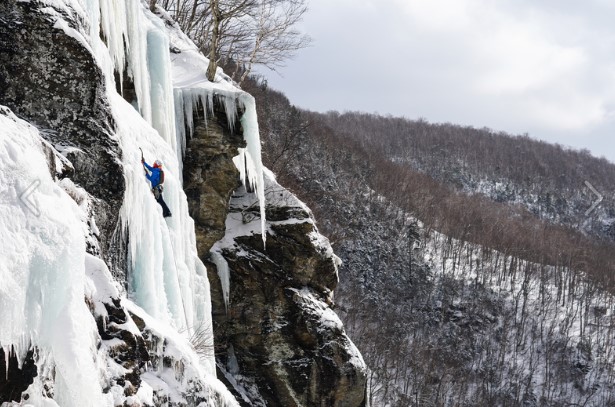
Okay, I was curious & had to figure this out. Here's the general area where the guy went off the cliff, it's an ice climbing area called, "Doug's Route" according to the news (link below). Apparently he went to look over the edge & lost his footing.


If you see the dashed-line at the top of Sensation, heading toward the pond (Sterling), they should have gone in that direction, but it appears they must have went left off Sensation instead.

South-Wall.jpg


Doug-s-Route.jpg


https://patch.com/connecticut/vernon/connecticut-skier-killed-vermont-backcountry-accident
 

deadheadskier

Moderator
Staff member
Moderator
Joined
Mar 6, 2005
Messages
27,969
Points
113
Location
Southeast NH
Here’s what I think happened. Blue is intent, red is what happened:

View attachment 26490


Sent from my iPhone using AlpineZone
Yikes! If that was what happened, that's terrifying.

So Tusk is the prominent Gully you see that you access off Upper Smugglers Trail on Spruce just above where US can cut off back towards Main Street. Relevant to this conversation, I've skied Tusk a few times alone when I probably shouldn't have because the snow is very hit or miss in it and when it's bad, it's dangerously bad. Basically from Tusk to your blue zone is I don't think skied by really anyone. Maybe some secrets in there I don't know about these days as it's been 15 years since Stowe was home, but nobody I knew back then was really going out there. I always basically have skied blue and on down to Sterling lift at Smuggs. Never hoofed it back over to Stowe. It's basically no different from Stowe side vs Smuggs. You ski out towards the middle and drop in. I do recall one time I ventured towards "red" in search of fresh snow when the bowl was tracked out and actually got cliffed out and had to hike back up a little bit . But it was like a 30 foot cliff and you could easily see it coming. I thought maybe there might be something to the left of it, but it was just totally dense fir trees and then the cliff just keeps growing the further skiers left up into red to probably 200+ feet like you said.

On the Mansfield side I never ventured much further into the notch than Hellbrook. People do push it further that way, but again you run the risk of getting on top of some 100 foot plus cliffs.

It honestly surprises me there aren't more side country deaths at Stowe. So many places to get into serious trouble that are not too much effort to reach from the lifts.

Sent from my XT1635-01 using AlpineZone mobile app
 

bdfreetuna

New member
Joined
Jan 12, 2012
Messages
4,300
Points
0
Location
keep the faith
Good intel from you guys as sad as this topic is.

DHS... is Hellbrook the very clear and obvious, extreme looking diagonal directly across from Smuggs back bowls? Resembled a narrow version of Hillman's Highway.

It seems to line up on the topo map with what I was looking at, but again I'm talking a real narrow vertical gully for 1500 vert by all appearances.

Anyway if you skied that... very brave. I'd like to explore beyond Angel Food more but 0% chance I'm skiing that gully.
 

bdfreetuna

New member
Joined
Jan 12, 2012
Messages
4,300
Points
0
Location
keep the faith

Vaughn

Member
Joined
Feb 26, 2017
Messages
146
Points
18
Fatmap is very cool but odd in that Stowe has some backcountry stuff marked but other places in NH don't seem to. Is that all user added content?
 

deadheadskier

Moderator
Staff member
Moderator
Joined
Mar 6, 2005
Messages
27,969
Points
113
Location
Southeast NH
Kind of answered my own question looking at FatMap

https://fatmap.com/routeid/30328/He...98,-15.8610162,-76.0897041,651.0446029,normal

So yes Hellbrook is what I was looking at --- looks insane at least from perspective across the road.

Also I guess I've skied "Outer Planet #1" a few times thinking it was just part of Angel Food. Guess the next 2 routes are next on the list.

This map is pretty sweet...
That map outlines Hellbrook yes, but no you can't see it from Smuggs back bowls. If you were standing in Smuggs back bowls looking out straight, Hellbrook would probably be at least a mile looking left and around the curve of the notch out of view. I'm not certain what the "diagonol" line is you spied.

Hellbrook itself really isn't easy, but not at all that crazy either. It skis like 19th hole at MRG for the top 500 vertical, so tight spruce trees, then skis like Angel Food or Outer Planets for the bottom 1500 vert. The challenge is getting there. You either ski Profanity or Hourglass and hike 30 or 40 minutes up around the Adams Apple to get there or catch the North Ridge off the Chin when it's skiable, which is rare. When that's in it runs right out almost to the entrance of Hellbrook with maybe a 10 minute hike. Only caught North Ridge right a couple of times; it's typically picked clean of most snow by the wind.


Sent from my XT1635-01 using AlpineZone mobile app
 
Joined
Sep 22, 2010
Messages
161
Points
16
Location
The Hinterlands
Here in the east, we don't have tree wells.

There are tree wells in the east, I can assure you. Fell in one head-first, not far off a marked trail at Jay Peak some years ago. Once my ski partners stopped laughing at my predicament, one of them pulled me out. Had they not been there, I might have suffocated, as the snow was piling up around my head and I was pretty stuck, and upside down.

What a sad story out of Stowe.
 

Not Sure

Well-known member
Joined
Dec 14, 2013
Messages
2,858
Points
63
Location
Lehigh County Pa.
Website
www.youtube.com
I'd be curious if they were using GPS to navigate or from experience ? I've been sent the wrong way by my phone GPS , snowy misty day if it wasn't for the highway noise I would have ended up on a slippery leafy area .

I ski the woods alone at times but not very deeply but within shouting distance. At Killington may years ago skiing a gully a few turns and it collapsed . I was up to my neck and could hear running water below :eek:

When I was younger it was all about seeking a greater thrill , I was half way down mount standish at Sunshine village. Not satisfied with the trail I was on ,I spotted a set of tracks between two pine trees . 10' Away and committed I realized my error as I was airborne off a 30' cliff fortunately I landed in a big snowdrift . So not happy with clearing the drift I hit it again with more speed :grin:

Some pretty hairy accidental cliff drops on youtube.
 

Smellytele

Well-known member
Joined
Jan 30, 2006
Messages
9,952
Points
113
Location
Right where I want to be
From my perspective, the biggest danger in the woods is catching your ski on some little stump or other hidden feature such it causes you to either fall haphazardly or temporarily lose control, with the attendant risk of hitting something hard and immovable. This danger is heightened when there is marginal cover.

I don't consider cliffs much of a danger in the east. Different story out west.

I have come across a few cliffs in the last week. One at Bolton (15-20 foot) and a few at Stowe 20-25'
 

bdfreetuna

New member
Joined
Jan 12, 2012
Messages
4,300
Points
0
Location
keep the faith
Looks like (Extreme) Ryan Delena uploaded the Stowe info to Fat Map. He's on YouTube and other social media and you've probably seen him if you search for sidecountry in NH & VT.

That map outlines Hellbrook yes, but no you can't see it from Smuggs back bowls. If you were standing in Smuggs back bowls looking out straight, Hellbrook would probably be at least a mile looking left and around the curve of the notch out of view. I'm not certain what the "diagonol" line is you spied.

I think I figured it out... so the larger yellow overlay to the right is the gully/rock slide I was thinking of and looking at. I'm sure people have skied this, whatever it is, but it looks very extreme.

Based on your correction I am thinking the smaller green overlay to the top left must be the start of Hellbrook?

3725.jpg

According to this topo map I have to assume it's the top of Jeff's Slide, or perhaps the next one over.
https://caltopo.com/m/RH9Q
 

KustyTheKlown

Well-known member
Joined
Mar 1, 2013
Messages
5,406
Points
113
Location
Brooklyn
I'd be curious if they were using GPS to navigate or from experience ? I've been sent the wrong way by my phone GPS , snowy misty day if it wasn't for the highway noise I would have ended up on a slippery leafy area .

I ski the woods alone at times but not very deeply but within shouting distance. At Killington may years ago skiing a gully a few turns and it collapsed . I was up to my neck and could hear running water below :eek:

When I was younger it was all about seeking a greater thrill , I was half way down mount standish at Sunshine village. Not satisfied with the trail I was on ,I spotted a set of tracks between two pine trees . 10' Away and committed I realized my error as I was airborne off a 30' cliff fortunately I landed in a big snowdrift . So not happy with clearing the drift I hit it again with more speed :grin:

Some pretty hairy accidental cliff drops on youtube.

even just using the basic "for recreational purposes only" ski tracks app would have clearly showed them that they were in a very bad zone.
 

deadheadskier

Moderator
Staff member
Moderator
Joined
Mar 6, 2005
Messages
27,969
Points
113
Location
Southeast NH
Looks like (Extreme) Ryan Delena uploaded the Stowe info to Fat Map. He's on YouTube and other social media and you've probably seen him if you search for sidecountry in NH & VT.


I think I figured it out... so the larger yellow overlay to the right is the gully/rock slide I was thinking of and looking at. I'm sure people have skied this, whatever it is, but it looks very extreme.

Based on your correction I am thinking the smaller green overlay to the top left must be the start of Hellbrook?

View attachment 26491

According to this topo map I have to assume it's the top of Jeff's Slide, or perhaps the next one over.
https://caltopo.com/m/RH9Q
Correct

Green is Hellbrook. As for Yellow, I would think if people were skiing that they are probably hiking up from the Notch floor instead of heading over from the top of Mansfield. I would think that would be both faster and safer to check snow stability

Sent from my XT1635-01 using AlpineZone mobile app
 

nhskier1969

Active member
Joined
Feb 1, 2016
Messages
390
Points
28
There are tree wells in the east, I can assure you. Fell in one head-first, not far off a marked trail at Jay Peak some years ago. Once my ski partners stopped laughing at my predicament, one of them pulled me out. Had they not been there, I might have suffocated, as the snow was piling up around my head and I was pretty stuck, and upside down.

What a sad story out of Stowe.

I agree with you. I was skiing two years ago At Sugarbush at the end of Feb early march after a good storm cycle. Family was sleeping in so I broke my own cardinal rule. Never ski in the woods by myself. I Dropped in to skiers right about a couple hundred yards on Paradise. I was skiing and I was going a little faster than I wanted to, So a slowed myself down, but I fell going forward at a slower speed. Anyway I fell in to a group of small pine trees that were close to each other. I fell into the group of small pines and ended up with my head facing up and my feet were even with the head. It was almost like getting stuffed into a garbage barrel. It took me awhile to get out of there. The tails of my skis were stuck and I had a very hard time getting the skis kicked off. After a while, I was able to get on of my skis kicked off. Once I got my skis off I was standing in chest deep snow.


BTW, this was the second tree well I got caught in. The other was 10 years ago at Grand Targhee.
 
Top