• Welcome to AlpineZone, the largest online community of skiers and snowboarders in the Northeast!

    You may have to REGISTER before you can post. Registering is FREE, gets rid of the majority of advertisements, and lets you participate in giveaways and other AlpineZone events!

1/26 Manitoba Mauler

j law

New member
Joined
Jan 19, 2011
Messages
103
Points
0
Location
NYC
12z GFS is still really unimpressed with this storm, only puts down 12" in NYC and 6" in west NJ.

If the Euro is correct with the massive blizzard and the GFS is wrong, I'd say the millions of dollars in taxpayer money recently spent on GFS "upgrade" was wasted, because this would appear to be even worse than the prior GFS should the Euro be correct.


Do you have the map for the 12z GFS? Thanks Gomez!
 

billski

Active member
Joined
Feb 22, 2005
Messages
16,207
Points
38
Location
North Reading, Mass.
Website
ski.iabsi.com
12z GFS is still really unimpressed with this storm, only puts down 12" in NYC and 6" in west NJ.

If the Euro is correct with the massive blizzard and the GFS is wrong, I'd say the millions of dollars in taxpayer money recently spent on GFS "upgrade" was wasted, because this would appear to be even worse than the prior GFS should the Euro be correct.
do you see this being an acid test for the new an unimproved GFS?
 

billski

Active member
Joined
Feb 22, 2005
Messages
16,207
Points
38
Location
North Reading, Mass.
Website
ski.iabsi.com
Sadly, it's looking like my only option will be first tracks in Central Park early tomorrow morning.

I sure wish I was scheming a way around work and my wife to get to a ski area that was going to get slammed!!!

Oh well, snow is always more fun than no snow!


Sent from my iPhone using AlpineZone
It's going to be there for a long time. Besides, something else is forming for Thursday. Smaller for sure, but after this past month, I'm no whiner!
 

billski

Active member
Joined
Feb 22, 2005
Messages
16,207
Points
38
Location
North Reading, Mass.
Website
ski.iabsi.com
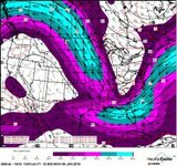
Pretty nasty winds. Think I'll go fly a kite...
attachment.php
 

Attachments

  • CONUS_NOGAPS_250_GPHTMPSPD_12HR.jpg
    CONUS_NOGAPS_250_GPHTMPSPD_12HR.jpg
    20.6 KB · Views: 175

deadheadskier

Moderator
Staff member
Moderator
Joined
Mar 6, 2005
Messages
28,171
Points
113
Location
Southeast NH
don't have details but heard on the radio - statewide travel ban starting tonight @ 9PM until the storm is over.

Thanks. Snowing yet? I'm in the Worcester area now. Trying to gauge how bad 84 will be around 3 or if I should head down sooner.
 

Tin

Active member
Joined
Oct 14, 2009
Messages
2,996
Points
38
Location
ZooMass Slamherst
Let's just keep the map porn going...Love to see these bands shift back west a bit for the Berks and southern NH/VT.

rgem_asnow_neus_16.png
 

BenedictGomez

Well-known member
Joined
Jan 26, 2011
Messages
12,343
Points
113
Location
Wasatch Back
do you see this being an acid test for the new an unimproved GFS?

How could it not be? It's already failed on the 2 previous shots on goal it had since the release.

Do you have the map for the 12z GFS? Thanks Gomez!

Sorry, I dont. Which is odd, because usually that's the easiest one to find and gets posted 1000 times all over. Which IMO means that pro mets are loathe to post it either because: A) they think it's crap. B) it 100% goes against their forecast.

Time will tell.
 

BenedictGomez

Well-known member
Joined
Jan 26, 2011
Messages
12,343
Points
113
Location
Wasatch Back
Let's just keep the map porn going...

rgem_asnow_neus_16.png

This is going to BUST huge in some areas.

For instance, this gives me maybe 6" total for where I live in New Jersey. Well, were that to verify it better stop snowing immediately and a giant hole better open up around my house for the next 20 hours, because we've already got a few inches. That right there tells me this Canadian map is too far east and needs to be brought west.
 
Last edited:

Tin

Active member
Joined
Oct 14, 2009
Messages
2,996
Points
38
Location
ZooMass Slamherst
This is going to BUST huge in some areas.

For instance, this gives me maybe 4" total for where I live in New Jersey. Well, were that to verify it better stop snowing immediately and a giant hole better open up around my house for the next 20 hours, because we've already got a few inches. That right there tells me this Canadian map is too far east and needs to be brought west.


I agree, can see that 24"+ band setting back a few miles and the Berks, W CT, and western LI getting crushed. Then drive 10 miles in each direction and the snowfall is half as much. Where those strong bands set up is the key. This will not be like Nemo though, you won't see places get 10"+ in an hour like what happened in eastern and SW CT and get 30-40". Long drawn out with 2-4" per hour.
 

BenedictGomez

Well-known member
Joined
Jan 26, 2011
Messages
12,343
Points
113
Location
Wasatch Back
Noon update:

THE 12Z GFS IS A LITTLE DEEPER AND FASTER THAN ITS 00Z RUN AT 500
MB AS THE LOW CLOSES OFF AND THEN MOVES FROM THE NORTHERN MID
ATLANTIC TO THE SOUTHERN NEW ENGLAND COAST ON TUE. OVERALL
HOWEVER...RUN-TO-RUN DIFFERENCES BETWEEN THE 00/06/12Z RUNS ARE
MINOR. IN COMPARISON TO THE LATEST DETERMINISTIC RUNS...THE GFS
REMAINS BETTER CLUSTERED WITH THE 00Z UKMET/CANADIAN GLOBAL ALONG
THE EASTERN/PROGRESSIVE EDGE OF THE GUIDANCE.


CONFIDENCE IS TEMPERED BY THE LINGERING MODEL SPREAD...HOWEVER
GIVEN THE ORIENTATION OF THE SYSTEM (NEGATIVE TILT) AND A
SIGNIFICANT UPSTREAM RIDGE NOSING INTO THE CANADIAN MARITIMES...A
SLOWER AND MORE AMPLIFIED SOLUTION SIMILAR TO THE LATEST NAM/ECMWF
SEEMS MORE PLAUSIBLE THAN THE FASTER CAMP.


Basically NWS is scared that there is such large disagreement with the models so close to the event, but they're siding with the more western ECMWF/NAM.
 

ChicoKat

New member
Joined
Feb 27, 2012
Messages
64
Points
0
Location
Thornton NH
What would have to happen with this one to move it west enough to really slam NH/VT/ME northern mountains? Seems like everything of late has tended to be more west of predicted track.
 

Tin

Active member
Joined
Oct 14, 2009
Messages
2,996
Points
38
Location
ZooMass Slamherst
Things have trended more east, not much hope for northern NE getting a bunch. Best we can hope for is deform bands stretching into southern VT and NH. Not much of a possibility of places further north than the Bromley/Magic/Pats/Sunappe getting 12+, maybe even 8" sadly.

That being said Pats, Sunapee, Crotched could see 2 feet and places like Cannon just an hour or so north get 6". Trying to pin down the big amounts is tough, all depends on where those bands set up. As I mentioned earlier crazy things happen in these storms and some place can get rocked with 11" in an hour and 10 miles east a dry slot moves in. Somewhere will get 30" and close by somewhere will only have 18". We won't know until it starts.
 
Last edited:
Top