• Welcome to AlpineZone, the largest online community of skiers and snowboarders in the Northeast!

    You may have to REGISTER before you can post. Registering is FREE, gets rid of the majority of advertisements, and lets you participate in giveaways and other AlpineZone events!

2/12 storm speculation

Status
Not open for further replies.

abc

Well-known member
Joined
Mar 2, 2008
Messages
5,868
Points
113
Location
Lower Hudson Valley
ah..im back. people making possible life and death decisions based on weather hero benedict gomez. this is perfect. make your decision of whether to drive in a possible blizzard based on a guy who has no meteorological education/experience....really good idea.
Someone's taking the internetz far too seriously.

And he thinks everyone else is taking it as seriously as he does.

unlike you guys, because I don't spend 99% of my day living it up on internet forums...
That explains it. Internetz virgin! ;)
 

lstone84

Member
Joined
Oct 8, 2012
Messages
131
Points
16
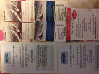
Hard to keep track of where I won em fromImageUploadedByAlpineZone1392255226.744154.jpgImageUploadedByAlpineZone1392255248.061528.jpg


Sent from my iPhone using AlpineZone
 

wa-loaf

Well-known member
Joined
Jan 7, 2007
Messages
15,109
Points
48
Location
Mordor
... Winter storm warning remains in effect from 7 am thursday to 7 am est friday...
* locations... Include western... Central and interior northeast massachusetts... As well as southern new hampshire.
* hazard types... Snow possibly mixing with sleet and freezing rain for areas along a line from springfield to worcester ma northeast to manchester nh. Snowfall rates of 1 to 2 inches per hour will be possible.
* accumulations... snow accumulation of 12 to 16 inches... Along with around a tenth of an inch of ice.
* timing... Snow developing during thursday morning becoming heavy at times before changing to sleet and freezing rain late thursday and thursday evening... Mainly central and northeast ma. Heavy snow likely western ma to southern nh thursday night.
* impacts... Travel will be difficult early thursday into friday morning.
* winds... Northeast 10 to 20 mph with gusts up to 35 mph.
 

lstone84

Member
Joined
Oct 8, 2012
Messages
131
Points
16
Berkshire will be great. You have to look at the timing of the snow though and focus on where will get the most between lifts closing Thursday and lifts opening Friday. Western ME looks best for highest totals off hours. Otherwise it'll get somewhat to mostly tracked out Thursday depending on the mountain and when it starts.


Sent from my iPhone using AlpineZone
 

lstone84

Member
Joined
Oct 8, 2012
Messages
131
Points
16
Personally, I'd take 12-14 where most fell after lifts closed versus 16-18 where it was being tracked out all day. It will be good almost everywhere though with this storm.


Sent from my iPhone using AlpineZone
 

catsup948

New member
Joined
Dec 6, 2007
Messages
1,026
Points
0
Location
Shelburne Falls, MA
If the winds are as strong as forecasted driving anywhere after noon tomorrow is going to be a challenge. 1-2 inch and hour rates with 20-30 mph winds equals whiteout!

Sent from my SCH-I545 using Tapatalk
 

ALLSKIING

Moderator
Staff member
Moderator
Joined
Jan 6, 2005
Messages
6,969
Points
48
Location
East Setauket,NY/Killington,VT
i like how i was criticized in the beginning of this for NOT having many posts...as if sitting around and posting to a snow thread on the internet all day is cool....seriously benedict thanks for the laugh on that one.
Your getting yourself close to not being able to make any posts at all.
 

John W

Member
Joined
Oct 25, 2010
Messages
125
Points
16
Location
NYC
Headed to Elk !! Blue Pants, Blue North face jacket, black helmut! - THursday

Headed to Elk thursday in case anyone wants to head a little north


Wow, looks like a home run for the Catskills and Poconos. I want to do a run up to Camelback. I was thinking Thursday. Have Jeep, will travel in snow. I'm inclined to do Friday but I'm thinking with the beginning of a holiday weekend, a lot of people taking off early and the roads being cleared that CB will be a zoo. I'll probably have the place to myself on Thursday.

Looks like a rain/mix where I am. Hopefully this will trend NW.

Either way I get to listen to all my friend bitch about how horrible this winter is. I don't know..I'M having an AWESOME time! :snow:
 

mlctvt

Active member
Joined
Mar 24, 2006
Messages
1,533
Points
38
Location
CT
Looking good for southern VT NOAA Albany has upped the forecast for southern VT to 14"-18" now for Mount Snow and Magic. The total QFP is forecasted to be in the 1.5- 2.0" range with a possible 2.5" so these numbers are conservative. There's a possibility for more depending on the backend/upslope. Has anyone heard anything about wind following this storm? It'd really suck to have wind holds Friday/Saturday

StormTotalSnowWebFcst_2-13-14.jpg
 

BenedictGomez

Well-known member
Joined
Jan 26, 2011
Messages
12,193
Points
113
Location
Wasatch Back
Has anyone heard anything about wind following this storm? It'd really suck to have wind holds Friday/Saturday

I ran the wind maps around noon today for the weekend, and they looked shockingly gentle. Didnt bother with Friday since I cant ski then (travel day).
 

BenedictGomez

Well-known member
Joined
Jan 26, 2011
Messages
12,193
Points
113
Location
Wasatch Back
Has anyone heard anything about wind following this storm? It'd really suck to have wind holds Friday/Saturday

Wondering the same as above, any word on the wind Fri/Saturday?

Here you go. This is Friday. Looks lovely.

UV_PN_UU_VV_054_12000.gif


Saturday looks all good in the hood.

UV_PN_UU_VV_078_12000.gif


Only thing to note is this is a 12Z map, and obviously this should be revisited tonight given much better "real world" data will have been digested by the models, so it could easily change, but so far so good...
 
Status
Not open for further replies.
Top