• Welcome to AlpineZone, the largest online community of skiers and snowboarders in the Northeast!

    You may have to REGISTER before you can post. Registering is FREE, gets rid of the majority of advertisements, and lets you participate in giveaways and other AlpineZone events!

Long Range Possibility

BodeMiller1

Well-known member
Joined
Mar 7, 2022
Messages
2,073
Points
63
Location
Montpelier
No need for a map. All ski areas in New England will get from 4 to 17 inches of snow.

Pats Peak 12'

Killington 10'

Sunapee 15"

Sunday River 5"

Sugar Loaf 8"

Loon 10"

Cannon 10"

Hopefully it turns to rain at the very end to make sure the snow sticks to the slopes. Could be running the snowcats on the steep stuff during the storm. Snow is great, snow where it is skiable is more betterer.

And the beat goes on...
 

Abubob

Well-known member
Joined
Apr 9, 2010
Messages
3,580
Points
63
Location
Alexandria, NH
Website
tee.pub
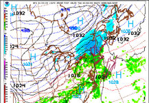
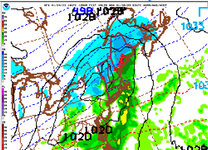
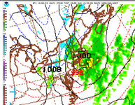
Firmly entrenched in a 7 day pattern. Monday looks a bit lie wet snow Next Wednesday starts off good up doesn’t end so well. Let’s hope it moves a little to the east.

545F94AA-ECCF-40D3-8786-F3C2935E799D.jpeg

CF94892E-82BC-45EE-8359-F6B082167B73.jpeg
 

eatskisleep

Well-known member
Joined
Dec 23, 2003
Messages
1,596
Points
83
Looking like some extreme bitter cold coming Friday night. -25 in Noco with -53 windchill. Still early, but might be a good weekend to stay warm!
 

snoseek

Well-known member
Joined
Jun 7, 2006
Messages
6,386
Points
113
Location
NH
Net gain this week in northern area. We need dense stuff even though all we seems to get is dense stuff.
 

Abubob

Well-known member
Joined
Apr 9, 2010
Messages
3,580
Points
63
Location
Alexandria, NH
Website
tee.pub
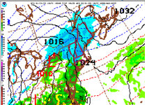
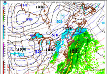
More to come. This is for Tuesday. Notice the Low forming between NJ and LI. That‘s the counter rotation we need. Still doesn’t look like we’ll get Thursday into Friday. That’ll help build back the glades and maybe the next storm will set them up nicely.

3CA6699E-95A5-4612-9B5D-0F00DB8F5733.jpeg
 

4aprice

Well-known member
Joined
Mar 14, 2008
Messages
3,978
Points
63
Location
Lake Hopatcong, NJ and Granby Co
Rumors I'm hearing may be turning some frowns around for March and into April. SSW (sudden stratopheric warming) going on now, usually results in pattern change and some of the models are spitting out some juicy results.
 

Scottyskis2

Active member
Joined
Dec 17, 2022
Messages
433
Points
28
Mid week valley Hudson Valley weather forecast below
Maybe you get powered day this week :
:"
⚠️Mon PM/Tue PM Storm Update 2 with Prelim Snow Map⚠️

⚠️Winter Storm Watches in effect for parts of the region ⚠️

Synopsis 🤓- Double barrels low pressures impact the region, low pressure driving up to our west will weaken and transfer energy to newly formed coastal low. Data has trended to a western low weakening quickly and early transfer, the result is a colder solution. With western low not remaining in the driver seat longer, the WAA (Warm Air Advection) will not be as robust and change over line remains further south. Snow may fall heavily overnight Monday with snowfall rates approaching or exceeding 1” per hour under areas of banding. Travel overnight into Tuesday morning will be treacherous and should be avoided if possible. We will see some downslope shadowing across the river valley and points east where lower totals can be expected. The NWS has not issued a winter storm watch for these areas and it’s likely advisories will be issued instead. On the flip side we will see terrain enhanced snowfall on the southern and eastern slopes of the higher terrain.

Timing⏱️-
🟢Start- Monday 5pm-7pm from SW to NE
🛑Stop- Tuesday 4PM-6PM from SW to NE

Snowfall Amounts 📏-

Do you reside within the yellow circled area?

Yes- 3”-6” with the lowest amounts south and where downslope effects are felt.

Do you reside within the blue circled area?
Yes- 4”-8” with locally higher amounts possible, especially if….. ⬇️

You reside within the red circle?
This area is likely to see the highest amounts where 5”-10” of snow is possible, highest amounts across the higher terrain.

What can go wrong? 🧐

We still have 24+ hours between us and the precipitation, this storm will have a tricky transfer of energy to a secondary low pressure. The timing of that transfer, how close the secondary low forms to the coast and where it tracks once it does, will all have impacts on the forecast. We will aim to bring our prelim to a final forecast this evening, if our prelim holds up well to a days worth of new data, we will change nothing.

Images-
HVW Prelim Snow Forecast
NWS Current Winter Storm Headlines
GFS/Euro/NAM- Projected Snowfall as of Sun AM Data

-Alex"
 

Scottyskis2

Active member
Joined
Dec 17, 2022
Messages
433
Points
28
* Next Winter Storm Takes Aim on Northeast & Hudson Valley*

With the Hudson Valley just experiencing a widespread 4 to 8 inches of snow, which for most of us was the largest snowfall of the season thus far, we are watching another similar storm system approach for the weekend.

... Summary ...
- Timing: Friday late PM into Saturday
- Snow / Wintry mix expected
- Possible impact / accumulation larger than previous storm

Computer guidance is in agreement of the setup, and general track of our next storm system. However the details regarding the position and timing of weather features ahead of the system will determine what type of precipitation, and how much snow falls in the Hudson Valley. Early guidance suggested the low pressure would move into the Great Lakes, causing snow to quickly change to sleet and rain (similar to the European model scenario). However, the trend in the computer guidance has been suggesting the primary low pressure in Ohio weakens faster, and transfers its energy to the secondary coastal low pressure faster. This would prevent the mild air in the mid-levels from moving as far north... which would translate into higher snowfall amounts in the Hudson Valley.

This storm system is larger, with more moisture than the Hudson Valley's previous storm system, so we will monitor the data closely and try to keep you a step ahead of the weather as we move into the weekend. Our analysis will include more detail (how much snow we expect, timeline of precipitation, how quickly the coastal low pressure becomes the primary low), as we get closer to the storm on Wednesday and Thursday.
From mid Hudson Valley weather page

-Bill
 

BodeMiller1

Well-known member
Joined
Mar 7, 2022
Messages
2,073
Points
63
Location
Montpelier
These systems are hard to predict. I'm going with average snow fall & temps in the northeast.
 

Abubob

Well-known member
Joined
Apr 9, 2010
Messages
3,580
Points
63
Location
Alexandria, NH
Website
tee.pub
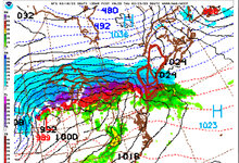
I see snow in the 2 week long range!! Of course that nothing compared to the week long blizzard that the remnants of Phillipe is bringing to Canada in the next few days.

IMG_3885.jpeg
 
Top