• Welcome to AlpineZone, the largest online community of skiers and snowboarders in the Northeast!

    You may have to REGISTER before you can post. Registering is FREE, gets rid of the majority of advertisements, and lets you participate in giveaways and other AlpineZone events!

Week of March 17 to 23 2013

WinnChill

New member
Joined
Nov 13, 2009
Messages
921
Points
0
Looks to me that the highest verticals are going to win out of this one. Head north!

This has some pretty decent signs of accumulations for many areas. A secondary low tries to develop right along the coast which would 1) tend to prevent mixing from going too far north (staying along MA for now), and 2) focusing most snow across same areas as last time--S VT thru NH and into S ME.

I'll try to keep up with everything this weekend but we're all out with a hockey tourney in ME. I'll check in as often as possible.
 

ScottySkis

Well-known member
Joined
Jan 16, 2011
Messages
12,294
Points
48
Location
Middletown NY
This has some pretty decent signs of accumulations for many areas. A secondary low tries to develop right along the coast which would 1) tend to prevent mixing from going too far north (staying along MA for now), and 2) focusing most snow across same areas as last time--S VT thru NH and into S ME.

I'll try to keep up with everything this weekend but we're all out with a hockey tourney in ME. I'll check in as often as possible.


Have fun time at the hockey event. Thanks again for very reliable weather predictions for out hills.:thumbup::thumbup::):)
 

Puck it

Well-known member
Joined
Oct 26, 2006
Messages
9,700
Points
48
Location
Franconia, NH
This has some pretty decent signs of accumulations for many areas. A secondary low tries to develop right along the coast which would 1) tend to prevent mixing from going too far north (staying along MA for now), and 2) focusing most snow across same areas as last time--S VT thru NH and into S ME.

I'll try to keep up with everything this weekend but we're all out with a hockey tourney in ME. I'll check in as often as possible.


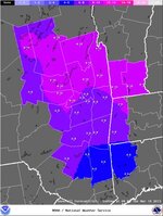
Hey, Winn. Can you give us more detail on the timing of the acculmalation for the northern Whites for Tues into Wed.

BTW, I am at a hocket tourney to, but in St. Louis for my son UCONN team.
 

billski

Active member
Joined
Feb 22, 2005
Messages
16,207
Points
38
Location
North Reading, Mass.
Website
ski.iabsi.com
You going to the Bush next weekend? How much snow you think for high elevations?

No clue. This late in the season you need to trust Ullr. Bush Usually does well, but even better, Stowe or Jay will do well in VT. If it was me (depending where I'm staying in VT), I might consider Bush, Stowe or Jay depending on how the weather flushes out.
 

Masskier

New member
Joined
Sep 21, 2004
Messages
721
Points
0
Location
South of Boston, Burke Mt VT
From BTV


LONG TERM /TUESDAY THROUGH SATURDAY/... AS OF 425 PM EDT SATURDAY...LITTLE OVERALL CHANGE FROM PREVIOUS FORECASTER THINKING FOR THE EXTENDED PORTION OF THE FORECAST AS GUIDANCE REMAINS IN VERY GOOD AGREEMENT. WIDESPREAD SNOW EVENT WILL BY UNDERWAY TUESDAY MORNING AS A STRONG UPPER TROUGH MOVING INTO THE UPPER GREAT LAKES REGION BECOMES NEGATIVELY TILTED AND A SURFACE LOW BEGINS TO FORM ALONG THE DELMARVA COASTLINE. GEM/GFS/ECMWF ALL IN EXCELLENT AGREEMENT TAKING THE SURFACE LOW NORTHEAST RIGHT OVER CAPE COD BY TUESDAY EVENING WHILE INTENSIFYING...SETTING UP A VERY FAVORABLE SCENARIO FOR HEAVY SNOWFALL ACROSS THE BTV CWA. STILL A LITTLE FAR OUT IN TIME TO HASH OUT ALL THE FINER MESOSCALE DETAILS OF THE STORM IN REGARDS TO QPF/SNOW AND EAST/SOUTHEAST UPSLOPE/DOWNSLOPE POTENTIAL ALONG THE GREEN MOUNTAIN SPINE AND WHITE MOUNTAINS...BUT EARLY INDICATIONS ARE THAT THE NORTH COUNTRY WILL SEE A SIGNIFICANT LATE SEASON STORM WITH UPWARDS OF A FOOT OR MORE OF SNOW POSSIBLE THROUGH TUESDAY NIGHT. STAY TUNED. BY WEDNESDAY MORNING SURFACE LOW CONTINUES TO RACE NORTHEAST THROUGH THE NEW ENGLAND COASTAL WATERS TOWARDS NOVA SCOTIA WHILE THE UPPER TROUGH WILL BE SLOW TO CLEAR OUT OF THE AREA AND ESSENTIALLY PARKS ITSELF OVER THE NORTHEAST THROUGH FRIDAY...SLOWLY SHIFTING OFF THE COAST BY THE WEEKEND. WITH PLENTY OF COLD AIR AND MOISTURE AROUND...SO SCATTERED SNOW SHOWERS CAN BE EXPECTED THROUGH THE REMAINDER OF THE FORECAST PERIOD WITH THE HIGHEST SNOW TOTALS LIKELY OCCURRING ACROSS THE UPPER ELEVATIONS WITH PERIODS OF UPSLOPE ENHANCEMENT.
 

ScottySkis

Well-known member
Joined
Jan 16, 2011
Messages
12,294
Points
48
Location
Middletown NY
From BTV


LONG TERM /TUESDAY THROUGH SATURDAY/... AS OF 425 PM EDT SATURDAY...LITTLE OVERALL CHANGE FROM PREVIOUS FORECASTER THINKING FOR THE EXTENDED PORTION OF THE FORECAST AS GUIDANCE REMAINS IN VERY GOOD AGREEMENT. WIDESPREAD SNOW EVENT WILL BY UNDERWAY TUESDAY MORNING AS A STRONG UPPER TROUGH MOVING INTO THE UPPER GREAT LAKES REGION BECOMES NEGATIVELY TILTED AND A SURFACE LOW BEGINS TO FORM ALONG THE DELMARVA COASTLINE. GEM/GFS/ECMWF ALL IN EXCELLENT AGREEMENT TAKING THE SURFACE LOW NORTHEAST RIGHT OVER CAPE COD BY TUESDAY EVENING WHILE INTENSIFYING...SETTING UP A VERY FAVORABLE SCENARIO FOR HEAVY SNOWFALL ACROSS THE BTV CWA. STILL A LITTLE FAR OUT IN TIME TO HASH OUT ALL THE FINER MESOSCALE DETAILS OF THE STORM IN REGARDS TO QPF/SNOW AND EAST/SOUTHEAST UPSLOPE/DOWNSLOPE POTENTIAL ALONG THE GREEN MOUNTAIN SPINE AND WHITE MOUNTAINS...BUT EARLY INDICATIONS ARE THAT THE NORTH COUNTRY WILL SEE A SIGNIFICANT LATE SEASON STORM WITH UPWARDS OF A FOOT OR MORE OF SNOW POSSIBLE THROUGH TUESDAY NIGHT. STAY TUNED. BY WEDNESDAY MORNING SURFACE LOW CONTINUES TO RACE NORTHEAST THROUGH THE NEW ENGLAND COASTAL WATERS TOWARDS NOVA SCOTIA WHILE THE UPPER TROUGH WILL BE SLOW TO CLEAR OUT OF THE AREA AND ESSENTIALLY PARKS ITSELF OVER THE NORTHEAST THROUGH FRIDAY...SLOWLY SHIFTING OFF THE COAST BY THE WEEKEND. WITH PLENTY OF COLD AIR AND MOISTURE AROUND...SO SCATTERED SNOW SHOWERS CAN BE EXPECTED THROUGH THE REMAINDER OF THE FORECAST PERIOD WITH THE HIGHEST SNOW TOTALS LIKELY OCCURRING ACROSS THE UPPER ELEVATIONS WITH PERIODS OF UPSLOPE ENHANCEMENT.

I like this very very much.:):):):thumbup::thumbup::thumbup::thumbup::beer::cool::cool::cool:
 

WinnChill

New member
Joined
Nov 13, 2009
Messages
921
Points
0
Hey, Winn. Can you give us more detail on the timing of the acculmalation for the northern Whites for Tues into Wed.

BTW, I am at a hocket tourney to, but in St. Louis for my son UCONN team.

Nice! This is our first tourney--Squirt team did good. They didn't make the finals but they didn't lose a game either--very proud.

Sure--bulk of it hits late Tuesday/Tuesday night...Wed would be day to hit up slopes.
 

billski

Active member
Joined
Feb 22, 2005
Messages
16,207
Points
38
Location
North Reading, Mass.
Website
ski.iabsi.com
is it gonna be all snow, or a mix?

In an earlier note in this thread, Winnchill indicated:

A secondary low tries to develop right along the coast which would 1) tend to prevent mixing from going too far north (staying along MA for now), and 2) focusing most snow across same areas as last time--S VT thru NH and into S ME.

Everything I'm seeing says the same thing = north of Albany, northern Mass Border, = all snow, and a good dump of it. I don't know how to figure out the moisture content. I'm sure winnchill will have something to say in between the games. :)
 

octopus

Member
Joined
May 4, 2008
Messages
397
Points
16
Location
mass
In an earlier note in this thread, Winnchill indicated:

A secondary low tries to develop right along the coast which would 1) tend to prevent mixing from going too far north (staying along MA for now), and 2) focusing most snow across same areas as last time--S VT thru NH and into S ME.

Everything I'm seeing says the same thing = north of Albany, northern Mass Border, = all snow, and a good dump of it. I don't know how to figure out the moisture content. I'm sure winnchill will have something to say in between the games. :)

very nice. it didn't have this info on the mobile app when i checked it earlier, was saying possible mix further north. thx:snow::snow:
 

Puck it

Well-known member
Joined
Oct 26, 2006
Messages
9,700
Points
48
Location
Franconia, NH
Nice! This is our first tourney--Squirt team did good. They didn't make the finals but they didn't lose a game either--very proud.

Sure--bulk of it hits late Tuesday/Tuesday night...Wed would be day to hit up slopes.


Thx
 

billski

Active member
Joined
Feb 22, 2005
Messages
16,207
Points
38
Location
North Reading, Mass.
Website
ski.iabsi.com
Regarding rain/ice/snow line


NATIONAL WEATHER SERVICE TAUNTON MA
1042 AM EDT SUN MAR 17 2013

SO FEEL THE STORM WILL PLAY OUT IN THE FOLLOWING...LIGHT PRECIP WILL
OVERSPREAD THE REGION BECOMING MODERATE INTO TUESDAY MORNING. EXPECT
SNOW FOR MOST AREAS EXCEPT S RHODE ISLAND AND S MASSACHUSETTS
INCLUDING THE CAPE AND ISLANDS. A MESSY MORNING COMMUTE IS EXPECTED.

DURING THE DAY...THE MIX LINE /SNOW-SLEET-FREEZING RAIN/ TRANSITIONS
SLOWLY INTO THE INTERIOR. ANTICIPATING LOCALES EAST OF THE I-495
BELTWAY AND SOUTH OF THE I-84 TO I-90 CORRIDOR TO CHANGE OVER TO
RAIN...WHILE A WINTRY MIX PREVAILS NORTH AND WEST.

INTO EVENING...MUCH OF THE PRECIPITATION IS EXITING OUT AS DRIER
NORTHWEST FLOW PREVAILS ... FEEL RAIN WILL
TRANSITION BACK TO SLOW QUICKLY SOUTH AND EAST /BEST CHANCES ACROSS
EASTERN AND NORTHEAST MASSACHUSETTS
...
THIS STILL REMAINS AN UNCERTAIN FORECAST TO A DEGREE WITH REGARDS TO
SENSIBLE WEATHER DETAILS AND PRECIPITATION TYPES

*/WEDNESDAY AND BEYOND...STORM HAS LIFTED OUT OF THE AREA EARLY. GUSTY N/NW WINDS ...FOR WEDNESDAY.


NATIONAL WEATHER SERVICE ALBANY NY
1045 AM EDT SUN MAR 17 2013

...THIS PLACES MOST OF THE REGION
WITHIN SNOW. HOWEVER...ENOUGH WARM AIR MAY MAKE INTO PORTIONS OF
THE CATSKILLS...MID HUDSON VALLEY AND NORTHWEST CONNECTICUT FOR A
MIXTURE OF SNOW/SLEET/FZRA
WHICH WILL BE HIGHLY DEPENDENT ON THE
BOUNDARY LAYER TEMPERATURES. FURTHER NORTH...FORECAST PROFILES
SUGGEST THIS WARM NOSE MAY SNEAK UP THE MID HUDSON VALLEY REGION
TOWARD ALBANY AND THE TACONICS FOR A MIXTURE OF SNOW AND SLEET
. SO
WE WILL PLACE THE HIGHEST CHANCE FOR ICE ACCUMULATIONS ACROSS THE
CATSKILLS AND PORTIONS OF THE MID HUDSON VALLEY AND NORTHWEST
CONNECTICUT. THERE IS STILL UNCERTAINTY TO THE OVERALL THERMAL
PROFILES AT THIS TIME. OTHERWISE...THIS MAY BE SHAPING UP FOR A
MAINLY SNOW EVENT FOR THE ENTIRE REGION. SINCE WE ARE LOOKING AT A
MONDAY NIGHT INTO TUESDAY EVENT...

NATIONAL WEATHER SERVICE BURLINGTON VT
1047 AM EDT SUN MAR 17 2013


LATE MONDAY INTO TUESDAY. THIS WILL PRODUCE A LONG DURATION SNOWFALL...WITH A SIGNIFICANT SNOW
ACCUMULATION
LIKELY FOR THE NORTH COUNTRY
...
A WET/HIGH
DENSITY SNOW IS EXPECTED ACROSS THE VALLEYS WITH A FEW POWER
OUTAGES AND SOME TREE DAMAGE POSSIBLE. WINTER STORM WATCHES WILL
LIKELY BE NEEDED LATER TODAY...AS EVENT BECMS CLOSER. EARLY SNOW
TOTALS ARE 6 TO 12" VALLEYS AND 12 TO 20" IN THE MTNS BY WEDS
AFTN.

FEEL MOISTURE/QPF WL COME IN TWO SURGES FROM MONDAY NIGHT THRU TUESDAY..
ON MONDAY NIGHT...WITH ACCUMULATIONS OF 2 TO 6 INCHES LIKELY. ADDITIONAL HEAVY
SNOW ACCUMULATION WL BE LIKELY LATE TUES AFTN INTO WEDS WITH

SNOW RATIOS WL BE HIGHER AT NIGHT 15 TO 1...AND LESS DURING THE DAY :)


NOT BE SURPRISED IF SOME SLEET/EVEN RAIN MIXED IN NEAR RUTLAND/VSF AND
ACRS THE WESTERN DACKS FROM GOUVERNEUR TO POTSDAM.

FOR THE 2ND PART OF THE STORM...
THE FCST KEY WL BE HOW QUICKLY AND
WHERE SECONDARY SFC CYCLOGENESIS OCCURS ALONG THE COAST

THE INTENSITY OF THE SNOW WILL EVENTUALLY DECREASE ON WEDNESDAY...BUT STILL FAIRLY WIDESPREAD
OVER THE AREA. COME WEDNESDAY NIGHT LOW AND THEN WE WILL BE UNDER AN
EXTENDED PERIOD OF SCATTERED RAIN AND SNOW SHOWERS
 

billski

Active member
Joined
Feb 22, 2005
Messages
16,207
Points
38
Location
North Reading, Mass.
Website
ski.iabsi.com
NATIONAL WEATHER SERVICE GRAY ME
835 AM EDT SUN MAR 17 2013

WILL SEE PRECIPITATION MOVE INTO THE AREA MONDAY NIGHT...PROBABLY
HOLDING OFF UNTIL AFTER MIDNIGHT IN MOST ZONES. PRECIPITATION WILL
START AS SNOW EVERYWHERE AS DEEP COLD AIR MASS REMAINS IN PLACE.
BECOMING MORE CONFIDENT FOR A SIGNIFICANT SNOW EVENT FOR INLAND
LOCATIONS ESPECIALLY THE FOOTHILLS WHERE UPSLOPE FLOW WILL
ENHANCE PRECIPITATION. THE MOUNTAINS... OUTSIDE OF THE DOWNSLOPE
AREAS OF THE CONNECTICUT VALLEY... WILL ALSO GET SIGNIFICANT SNOW

FROM THIS AS WELL. :)

BUT MODELS ARE CONVERGING ON A MORE SNOWY SOLUTION FOR THE
COASTAL PLAIN... AND THIS MAY LIMIT ANY CHANGEOVER TO RAIN TO THE
IMMEDIATE COAST.

AND WILL STICK CLOSER TO THE GFS/NAM AMOUNTS ON THE ORDER
OF 1-1.25 INCHES... ALTHOUGH MAY SEE LOCALIZED AMOUNTS THAT HIGH
IN AREAS WHERE BANDING OCCURS. SNOWFALL RATIOS AWAY FROM THE
COAST ALSO LOOK TO BE CLOSER TO 10 TO 1 OR AS HIGH AS 15 TO 1 IN
THE NORTHERN ZONES... AND SNOW MAY NOT BE AS WET AS WE WOULD EXPECT
THIS TIME OF YEAR. :) :)
 

WinnChill

New member
Joined
Nov 13, 2009
Messages
921
Points
0
is it gonna be all snow, or a mix?

Tourney over and back home--kids did great...either tied or won all games but not enough to make final round. Still a great time.

Catching up now and did a quick update--limited mixing....maybe a bit into Pats/Crotched/McIntyre but that should be about it. Heaviest looks to be like last time--from about the Whites thru Sugarloaf...we upped accumulations closer to a foot for those areas.
 

BenedictGomez

Well-known member
Joined
Jan 26, 2011
Messages
12,546
Points
113
Location
Wasatch Back
I'm really hoping the warm air expected with this storm is overdone. Just ONCE this winter I'd like to see a decent snow in Jersey. Right now it's slated at 1" to 3" then rain for where I am, but if the models crap out on the temps we could get a good 8" or so....
 
Top