• Welcome to AlpineZone, the largest online community of skiers and snowboarders in the Northeast!

    You may have to REGISTER before you can post. Registering is FREE, gets rid of the majority of advertisements, and lets you participate in giveaways and other AlpineZone events!

I'm not seeing much snow in the week's forecast, anybody got a better one?

Warp Daddy

Active member
Joined
Jan 12, 2006
Messages
7,990
Points
38
Location
NNY St Lawrence River
I've skied my closest area( 72 miles distant) Titus mtn 1200 vert 3 times this past week .Titus has gotten 24 inches of fresh pow over that time period while Snow Ridge another area 85 miles distant picked up 43 inches this week . Gonna be there tomorrow :D gonna bring the snorkel
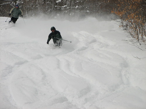
 

Euler

Active member
Joined
Jan 28, 2007
Messages
1,063
Points
36
Location
Southern Vermont
From NOAA/NWS for Southern Vermont:

ON WEDNESDAY...AND CONTINUING INTO THURSDAY...SOME LAKE EFFECT
MOISTURE WILL AFFECT THE ADIRONDACKS...OTHERWISE A MIX OF CLOUDS AND
SUN...AND TEMPERATURES AROUND NORMAL. BY FRIDAY...GENERAL CONSENSUS
FOR ANOTHER SYSTEM TO APPROACH. QUITE A SPREAD FROM LONG RANGE
ENSEMBLE GUIDANCE WITH REGARD TO STORM TRACK...TIMING AND THERMAL
PROFILE...BUT OPERATIONAL GFS AND ECMWF SUGGESTING INTERESTING STORM
TRACK FOR POTENTIAL SNOW IN OUR REGION...BUT AGAIN...ENSEMBLES
SUGGEST LOTS OF SPREAD AND UNCERTAINTY. JUST KEEPING CURRENT
FORECAST FOR CHANCES FOR SNOW MOST AREAS...AND MIX SOUTHERN AREAS
FRIDAY.


So...some chance is developing for a storm this Friday...
 

skimore

New member
Joined
Mar 15, 2005
Messages
217
Points
0
Tug

THE MEAN MID LEVEL TROUGH WILL BE CENTERED OVER THE WESTERN CONUS
THROUGH THE LONG TERM PERIOD...ALTHOUGH THERE WILL BE SEVERAL BRIEF
TROUGH AMPLIFICATIONS INTO THE GREAT LAKES. LOOKING AT THE
DETAILS...A STRONG COLD FRONT WILL CROSS THE EASTERN GREAT LAKES
REGION TUESDAY NIGHT. BEHIND THE COLD FRONT...STRONG COLD AIR
ADVECTION WILL BRING A RETURN TO MID WINTER CHILL. GFS/ECMWF ARE
DIVERGING SOMEWHAT ON THE DETAILS OF THE SURFACE PATTERN
EVOLUTION...WITH THE ECMWF DEEPER AND A LITTLE FARTHER WEST WITH THE
SURFACE LOW...AND ALSO COLDER AT 850MB. ECMWF WOULD SUGGEST MORE OF
A SOUTHWEST FLOW AND LAKE EFFECT CHANCES NORTHEAST OF LAKES ERIE AND
ONTARIO. GFS IS NOT AS COLD AT 850MB AND NOT AS AMPLIFIED...WHICH
WOULD SUPPORT MORE OF A WESTERLY FLOW WEDNESDAY AND LAKE EFFECT IN
THE MORE TRADITIONAL SNOWBELTS.

GIVEN THE LACK OF MODEL CONSISTENCY IN THE DETAILS AND INHERENT
UNCERTAINTY AT THIS TIME RANGE...IT REMAINS TOO EARLY TO BE SPECIFIC
ON EXACT LOCATION/INTENSITY...BUT THIS COULD BE ANOTHER STRONG LAKE
EFFECT SNOW EVENT GIVEN THE LARGE SCALE PATTERN AND VERY FAVORABLE
TEMPERATURES ALOFT. LAKE EFFECT SHOULD SHUT OFF BY THURSDAY
AFTERNOON AS A RIDGE OF HIGH PRESSURE BUILDS ACROSS THE EASTERN
LAKES.

has been very good the last week

2222259260_e6d7fb6c08.jpg
 

danny p

New member
Joined
Mar 6, 2007
Messages
726
Points
0
^^^^ that pic is worth several thousand words. looks great! Roemer and co. have been hinting at a chance of something sizeable Feb. 1st. Keeping my fingers crossed.
 

billski

Active member
Joined
Feb 22, 2005
Messages
16,207
Points
38
Location
North Reading, Mass.
Website
ski.iabsi.com
the "less than an inch" forecast has morphed to a day/night combined forecast of 2 to five.

hush with all that talk of niar. I'm hatching a plan for Fri/Mon and maybe Sun. Truth be told, I'm the only soul in New England that's not a football fan, and I plan to take full advantage of it.
;)
 

KingM

New member
Joined
Dec 30, 2004
Messages
977
Points
0
Location
Warren, VT (Sugarbush, MRG)
Website
www.goldenlionriversideinn.com
the "less than an inch" forecast has morphed to a day/night combined forecast of 2 to five.

hush with all that talk of niar. I'm hatching a plan for Fri/Mon and maybe Sun. Truth be told, I'm the only soul in New England that's not a football fan, and I plan to take full advantage of it.
;)

This is your weekend, then. I was looking at the reservation book yesterday and scratching my head wondering why we're busy each of the next three weekends except next and I had a "duh!" moment when I remember the Super Bowl and who is playing.

(Although frankly, why not just find a place with a TV and watch after skiing?)
 

billski

Active member
Joined
Feb 22, 2005
Messages
16,207
Points
38
Location
North Reading, Mass.
Website
ski.iabsi.com
This is your weekend, then. I was looking at the reservation book yesterday and scratching my head wondering why we're busy each of the next three weekends except next and I had a "duh!" moment when I remember the Super Bowl and who is playing.

(Although frankly, why not just find a place with a TV and watch after skiing?)

I am as un-American as it comes regarding team sports and television. I have no interest in the game at all, regardless of the drama or the team. I'm convinced Lenin was right, television is the opiate of the people ;) (no apologies forthcoming.) If I watch one hour of television a month, that would be huge. If I pulled up a chair, I am apt to be asleep within 10 minutes.
 

deadheadskier

Moderator
Staff member
Moderator
Joined
Mar 6, 2005
Messages
27,983
Points
113
Location
Southeast NH
solid 8" at Wildcat today, maybe more in places.


I don't want to complain because any fresh snow is good snow, I will say this was pretty much 'cold smoke' powder, just about at light as I've seen in New England. Things are good up at the Cat, but the hill definitely needs a good 12 inches of wet natural to get back to where things were at prior to the thaw


slowly, but surely it will come
 

SKIQUATTRO

New member
Joined
Oct 28, 2005
Messages
3,232
Points
0
Location
LI, NY
we'll be skiing Sunday as well....I dont care for football (or any pro sports for that matter) for a varitey of reasons....great day to ski as everyone is home preparing their Nachos!!
 
Top