• Welcome to AlpineZone, the largest online community of skiers and snowboarders in the Northeast!

    You may have to REGISTER before you can post. Registering is FREE, gets rid of the majority of advertisements, and lets you participate in giveaways and other AlpineZone events!

March 5 Storm?

BenedictGomez

Well-known member
Joined
Jan 26, 2011
Messages
12,546
Points
113
Location
Wasatch Back
Apparently the US government likes simplicity too...


1966831_684704088239847_730874265_n.jpg
 

Nick

Administrator
Staff member
Administrator
Joined
Nov 12, 2010
Messages
13,178
Points
48
Location
Bradenton, FL
Website
www.alpinezone.com
I saw something on Facebook yesterday that was showing 22" on Sunday all across lower VT and NH. I assume this must be a photoshop job making the rounds for all the non-skiers who are freaking out about yet another storm.
 

MadMadWorld

Active member
Joined
Jan 10, 2012
Messages
4,082
Points
38
Location
Leominster, MA
I saw something on Facebook yesterday that was showing 22" on Sunday all across lower VT and NH. I assume this must be a photoshop job making the rounds for all the non-skiers who are freaking out about yet another storm.

I think someone took a map from a different storm a few years ago. It was funny to see everyone freaking out
 

billski

Active member
Joined
Feb 22, 2005
Messages
16,207
Points
38
Location
North Reading, Mass.
Website
ski.iabsi.com
I saw something on Facebook yesterday that was showing 22" on Sunday all across lower VT and NH. I assume this must be a photoshop job making the rounds for all the non-skiers who are freaking out about yet another storm.

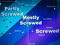
This is the correct map for all occasions. Insert your favorite city. :)

screwed.jpg

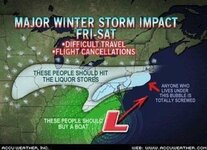
Flatlanders view of the storm:

FUNNY-WEATHER-MAP.jpg
 

BenedictGomez

Well-known member
Joined
Jan 26, 2011
Messages
12,546
Points
113
Location
Wasatch Back
And it figures I'm headed to central and northern Vermont next weekend.

Hopefully they can get 6" out of this, every bit helps the woods.
 

fbrissette

Well-known member
Joined
Mar 19, 2012
Messages
1,672
Points
48
Location
Montreal/Jay Peak
And it figures I'm headed to central and northern Vermont next weekend.

Hopefully they can get 6" out of this, every bit helps the woods.


The woods were fine last week-end and Jay has seen what appears to be a legit 8 inches (based on my balcony webcam) this week. Let me know if you want to talk climate change in the tram.
 

billski

Active member
Joined
Feb 22, 2005
Messages
16,207
Points
38
Location
North Reading, Mass.
Website
ski.iabsi.com
Good grief, Weather Channel has named this one TITAN.. How about fuffy, muffy or cuddles???
To use a name with such ominous overtones just fuels the fires in the flatlands.T
They muscle it up further with the headline:
TITAN: HEAVY SNOW, ICE THREATENS MILLIONS

It's no wonder people freak.
Can't wait to see next year's list :(
 

billski

Active member
Joined
Feb 22, 2005
Messages
16,207
Points
38
Location
North Reading, Mass.
Website
ski.iabsi.com
000
FXUS61 KBOX 281532
AFDBOX

AREA FORECAST DISCUSSION
NATIONAL WEATHER SERVICE TAUNTON MA
1032 AM EST FRI FEB 28 2014
...
A COMPLICATED FORECAST IN THE SIMPLEST OF TERMS.
...
THIS GREATLY HAMPERS
CONFIDENCE WITH REGARDS TO WHERE THE GREATEST OUTCOMES AND IMPACTS
WILL BE FELT.
...
CONSIDERING THE DISCUSSION ABOVE...AN OVER-RUNNING ALL SNOW EVENT
WITH MAINLY A FRONT-END THUMP CENTERED AROUND MONDAY IS ANTICIPATED.
DEPENDING ON WHERE THE AFOREMENTIONED FEATURES ALIGN...THERE IS THE
EXPECTATION FOR WEST-TO-EAST ... SNOWBANDING WHICH IS LIKELY
TO PRODUCE 1-2 INCH PER HOUR SNOWFALL RATES AND REDUCED VISIBILITIES
AT TIMES. CONFIDENT THAT MAJORITY OF IMPACTS WILL BE MAINLY S OF THE
MA/VT-NH BORDER...AND DURING BOTH MORNING AND EVENING COMMUTES...BUT
DIFFICULT TO PINPOINT EXACTLY WHERE. IT DOES APPEAR THE BEST CHANCES
FOR THE WORST OUTCOMES WILL BE IN PROXIMITY TO THE SOUTH-COAST.
...
BUT AGAIN...EXERCISING CAUTION. AGREE WITH THE PREVIOUS FORECASTER
THAT UNTIL ENERGY BECOMES BETTER SAMPLED NO ONE PARTICULAR SOLUTION
IS FAVORED. HIGHLY ENCOURAGE THE RECOMMENDATIONS COMMUNICATED BY WPC
...DERIVED FROM GFS OUTPUT WHICH CONTINUE TO GIVE THE GREATEST WEIGHT
OF SIGNIFICANT ACCUMULATING SNOWS SOUTH OF THE MA/VT-NH BORDER
 

BenedictGomez

Well-known member
Joined
Jan 26, 2011
Messages
12,546
Points
113
Location
Wasatch Back
Of COURSE.... after some of the most consistent modeling you'll ever see, where the GFS, Euro, and Canadian all agreed nearly perfectly with each other for DAYS, now that the storm approaches landfall they'll all arguing.

GFS went a bit south
Euro went a bit north
Canadian says, well I havent seen it yet, but I'm hearing it doesnt even have a friggin' storm anymore. WTH?

GFS below

1926251_10152287814638352_115156708_o.png
 

billski

Active member
Joined
Feb 22, 2005
Messages
16,207
Points
38
Location
North Reading, Mass.
Website
ski.iabsi.com
Of COURSE.... after some of the most consistent modeling you'll ever see, where the GFS, Euro, and Canadian all agreed nearly perfectly with each other for DAYS, now that the storm approaches landfall they'll all arguing.

GFS went a bit south
Euro went a bit north
Canadian says, well I havent seen it yet, but I'm hearing it doesnt even have a friggin' storm anymore. WTH?

GFS below

ask TWC. they know everything. Just pack your freaking bag. The season is moving on without you...
 

BenedictGomez

Well-known member
Joined
Jan 26, 2011
Messages
12,546
Points
113
Location
Wasatch Back
Good grief, Weather Channel has named this one TITAN.. How about fuffy, muffy or cuddles???
To use a name with such ominous overtones just fuels the fires in the flatlands.T
They muscle it up further with the headline:
TITAN: HEAVY SNOW, ICE THREATENS MILLIONS

The Weather Channel is a disgrace.

The ONLY purpose for their naming winter storms is to generate hype, media attention, ratings, and boost $$$$$$$.

1781977_685281764867790_811146104_n.jpg
 

yeggous

Active member
Joined
Oct 8, 2012
Messages
2,170
Points
36
Location
Eagle, CO
I really don't know why you are all talking about this. It is going to be a non-event. Ski country gets nothing and the rest of New England may get a plowable snow, or as we call it "Monday". Nobody cares about the clowns in the mid-Atlantic. They need to move.


Sent from my iPad using AlpineZone mobile app
 

BenedictGomez

Well-known member
Joined
Jan 26, 2011
Messages
12,546
Points
113
Location
Wasatch Back
The woods were fine last week-end and Jay has seen what appears to be a legit 8 inches (based on my balcony webcam) this week. Let me know if you want to talk climate change in the tram.

I would, but unfortunately I've already allocated my tram time to plotting the extermination of the Bicknell's Thrush.
 
Top