• Welcome to AlpineZone, the largest online community of skiers and snowboarders in the Northeast!

    You may have to REGISTER before you can post. Registering is FREE, gets rid of the majority of advertisements, and lets you participate in giveaways and other AlpineZone events!

Weekend of December 14th

billski

Active member
Joined
Feb 22, 2005
Messages
16,207
Points
38
Location
North Reading, Mass.
Website
ski.iabsi.com
BASE BUILDING!!!

WFO Boston
AT
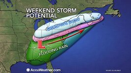
THIS EARLY STAGE THIS SCENARIO WOULD SUGGEST A WINTRY MIX TO RAIN
FOR THE COASTAL PLAIN INCLUDING PVD/BOS CORRIDOR. HOWEVER IF THIS
STORM TRACK VERIFIES SHALLOW COLD AIR WOULD BE DIFFICULT TO SCOUR
OUT ACROSS THE INTERIOR. THUS THERE IS A RISK FOR SIGNIFICANT
ACCUMULATION OF A WINTRY MIX WELL INLAND...ESPECIALLY GIVEN THIS
SOUTHERN STREAM SYSTEM WILL HAVE PLENTY OF QPF. NEVERTHELESS THIS
POTENTIAL EVENT IS STILL 4-5 DAYS AWAY SO ITS WAY TOO EARLY TO NAIL
DOWN SPECIFICS. NONETHELESS THE POTENTIAL FOR SIGNIFICANT WINTER
STORM THIS WEEKEND EXISTS.

albany:

FRI NT-SUN...MODELS ARE CONVERGING AT A HIGHER PROBABILITY OF SNOW
AFFECTING MUCH OF THE REGION DURING A PORTION OF THIS TIME
PERIOD..

BEHIND THIS SYSTEM...ARCTIC AIR WILL ONCE AGAIN SURGE INTO THE
REGION...WITH DAYTIME MAX TEMPS MONDAY EXPECTED TO ONLY REACH THE
TEENS AND 20S...WITH OVERNIGHT MINS FALLING INTO THE SINGLE DIGITS
ABOVE AND SLIGHTLY BELOW ZERO FOR SUN NT/MON AM.

gray, me wfo
12Z MODEL SUITE CONTINUES TO LOCK IN ON COASTAL STORM FOR SATURDAY
NIGHT INTO SUNDAY. EACH CONSECUTIVE RUN APPEARS TO BE COLDER AND
COLDER...WITH ARCTIC AIR IN PLACE KEEPING THE DRY SLOT TO OUR
SOUTH AND JUST OFF THE COAST. THIS SCENARIO WOULD BUMP UP OUR QPF
FROM EARLIER PROJECTIONS. STILL VERY EARLY IN THE GAME HERE...IN
FACT THE EURO RUN KEEPS THE HEAVY SNOW CONFINED TO SOUTHERN AND
CENTRAL AREAS...WITH THE NORTH ESCAPING THE MOST PRECIP AS THE
SURFACE LOW MOVES NORTHEAST...THEN EAST...BARELY REACHING
PORTLAND
 

drjeff

Well-known member
Joined
Jan 18, 2006
Messages
19,400
Points
113
Location
Brooklyn, CT
I guess I'll be taking my fat skis out of the storage room and clicking into them for the 1st time this season this weekend at Mount Snow :)
 

BenedictGomez

Well-known member
Joined
Jan 26, 2011
Messages
12,548
Points
113
Location
Wasatch Back
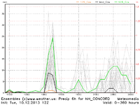
The Euro model is usually the best at handling northeastern winter storms, and today's 12z run is calling for a major storm, which is why everyone is now all aflutter. That said, some of the smartest mets I follow on FB/Twitter are poo-pooing this storm and think the models are mishandling some energy and WAY overdoing this. Cant wait to see tonight's model runs though - fingers crossed this storm picks up steam.
 

Huck_It_Baby

Active member
Joined
Oct 11, 2010
Messages
1,264
Points
36
Location
Colorado
That said, some of the smartest mets I follow on FB/Twitter are poo-pooing this storm and think the models are mishandling some energy and WAY overdoing this. Cant wait to see tonight's model runs though - fingers crossed this storm picks up steam.

Who do you follow?
 

BenedictGomez

Well-known member
Joined
Jan 26, 2011
Messages
12,548
Points
113
Location
Wasatch Back
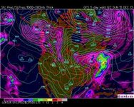
00z GFS is out, and it caved to the EURO!!!! :snow::spread::beer:

Has BIG inland snowstorm for entire Northeast!!!!

The snow bullseye of this storm for the entire region on this model run is right over......


(hopefully Scotty is sitting down)...............................


Plattekill.
 

BenedictGomez

Well-known member
Joined
Jan 26, 2011
Messages
12,548
Points
113
Location
Wasatch Back
Ran this map and posting it here to give the morning crew some early snow-porn.

Fingers are crossed this doesnt evaporate on future model runs. Will be interesting to see what the 00z Euro says when it comes out in 30 minutes (I'll be sleeping).

c16.gif
 

mriceyman

New member
Joined
Jan 4, 2012
Messages
1,344
Points
0
Location
cnj
I'm almost scared it's still 4 days out and it looks like this .. Praying for a huge dump
 

ScottySkis

Well-known member
Joined
Jan 16, 2011
Messages
12,294
Points
48
Location
Middletown NY
00z GFS is out, and it caved to the EURO!!!! :snow::spread::beer:

Has BIG inland snowstorm for entire Northeast!!!!

The snow bullseye of this storm for the entire region on this model run is right over......


(hopefully Scotty is sitting down)...............................


Plattekill.

Lol awesome news.:):):)
 

abc

Well-known member
Joined
Mar 2, 2008
Messages
5,935
Points
113
Location
Lower Hudson Valley
Has BIG inland snowstorm for entire Northeast!!!!

The snow bullseye of this storm for the entire region on this model run is right over......


(hopefully Scotty is sitting down)...............................


Plattekill.
yeah... but,

will it end with 'mixing' as so often in the past?
 
Top