-
Welcome to AlpineZone, the largest online community of skiers and snowboarders in the Northeast!
You may have to REGISTER before you can post. Registering is FREE, gets rid of the majority of advertisements, and lets you participate in giveaways and other AlpineZone events!
You are using an out of date browser. It may not display this or other websites correctly.
You should upgrade or use an alternative browser.
You should upgrade or use an alternative browser.
Weekend of December 14th
- Thread starter billski
- Start date
billski
Active member
bigbog
Active member
Thanks billski!
billski
Active member
sorry, I don't have time to make them larger.Thanks billski!
from_the_NEK
Active member
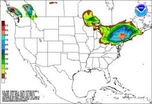
Looks like the spine of the greens is going to get 1-4 (south to north) on Friday before the "event".
View attachment 9767
Yeah, I'm thinking the central NEK will actually do better with Friday's little pre-storm front than it will with the "BIG" storm on Sunday.
billski
Active member
billski
Active member
Yeah, I'm thinking the central NEK will actually do better with Friday's little pre-storm front than it will with the "BIG" storm on Sunday.

Puck it
Well-known member
Show NH
ScottySkis
Well-known member
Looking beautiful.

Puck it
Well-known member
The map he's showing (like this one for NH) is for Friday's snow, NOT the weekend storm.
View attachment 9769
That is what I meant for to attach. I can never locate that on the NOAA website
billski
Active member
The models have diverged; we'll get something, just how much and where is an open book.
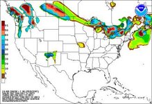
NAM THROUGH MONDAY:

GFS THROUGH MONDAY

NAM THROUGH MONDAY:

GFS THROUGH MONDAY

billski
Active member
That is what I meant for to attach. I can never locate that on the NOAA website
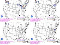
bookmark this. http://www.hpc.ncep.noaa.gov/wwd/winter_wx.shtml
They've really developed it into some awesome graphics.
billski
Active member
Some serious drugs going down there. 20:1 is going to be blower pow, not really what we need right now...The weather guys I follow for the local forecast think the ratios are going to start off in the 20:1 range and therefore believe totals will be higher with this system. This was their post of the GFS for Sunday.. looks petty good for the cats and dacks
GFS
Cannonball
New member
Some serious drugs going down there. 20:1 is going to be blower pow, not really what we need right now...
Huh? Blower pow is EXACTLY what I need right now.
Huck_It_Baby
Active member
Huh? Blower pow is EXACTLY what I need right now.
+1
billski
Active member
On zero base? When the backside winds blow it all off the trail? huh?
Huck_It_Baby
Active member
On zero base? When the backside winds blow it all off the trail? huh?
There's base enough in northern vermont at upper elevations that I have skied trees already.
Cannonball
New member
Pow in the Now!!
Everyone has been blowing snow like crazy for over a month. There is plenty of base to go around. I'm tired of turning on man-made. What we need is something to get deep in. We spend far too many seasons saying "Well it's good base building" for month after month.
Yes, 20:1 in the trees right now is still not going to be skiable. But guess what...it's New England we are going to get warm ups. And today's pow will be tomorrow's base.
Similar threads
- Replies
- 51
- Views
- 11K
- Replies
- 0
- Views
- 397


